Windermere and the Lake District.
Nice crisp morning light streamed through the window in our room at Kirkwood House.


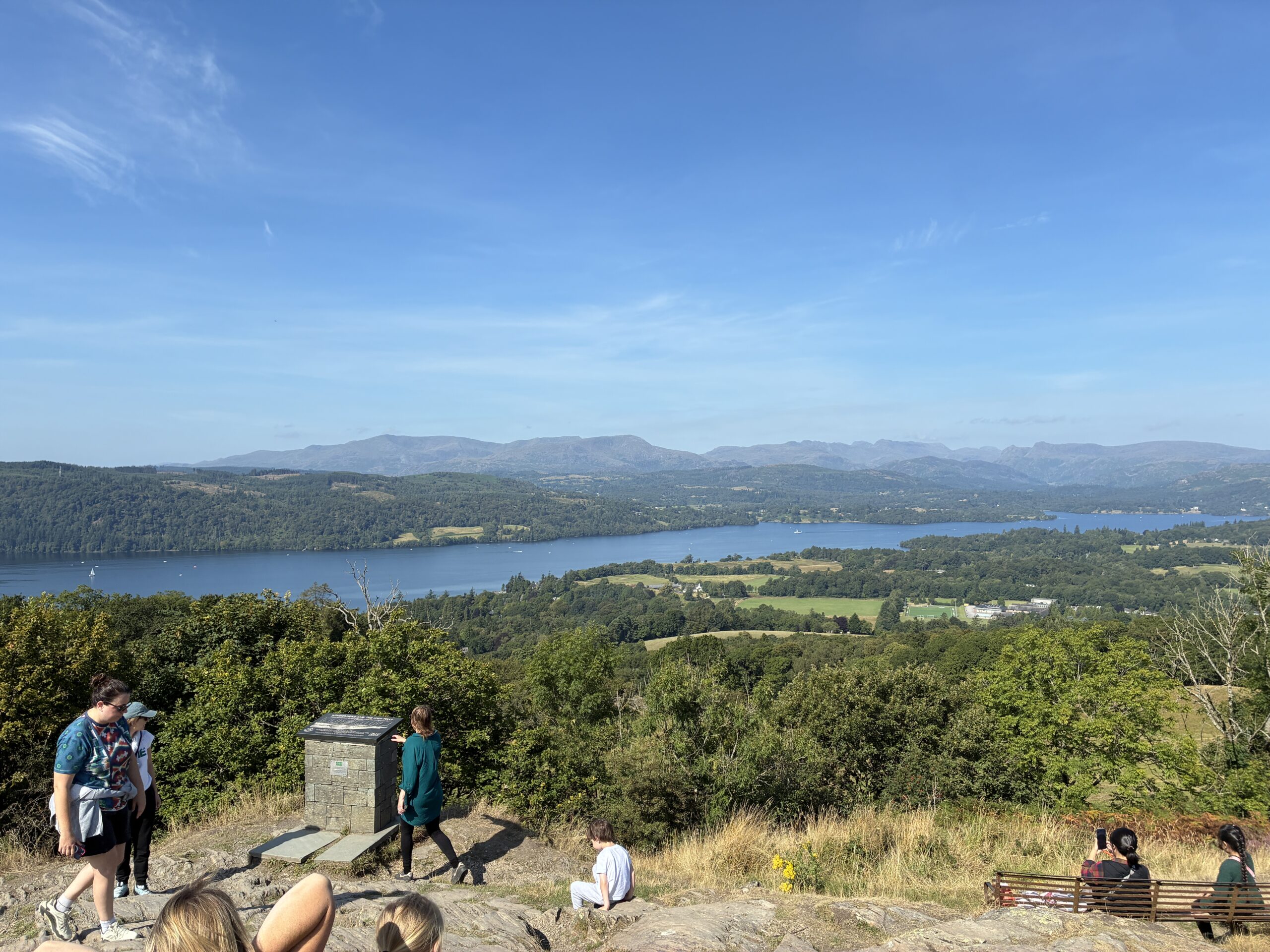
Tom grabbed breakfast at Kirkwood House while I finished blogging from yesterday, and then off we went, leaving around 10, and walked about 1½ miles or so to Orrest Head, with a beautiful view of Lake Windermere (actually, it’s just called Windermere) below and the mountains and fells of the central Lake District beyond. A fell is a northern English word for a high, open, and treeless hill or mountain, often covered with rough grass or heather rather than cultivated fields, and sometimes used for sheep grazing. The word comes from Old Norse word fjall, meaning mountain, which maybe says something about the distant history of this area.
The trail to the Orrest Head viewpoint, at an elevation of about 780 feet (but only maybe 400 feet above the village of Windermere), was, of course, lovely, with lovely weather (we’ve been very lucky with the weather) and picturesque views at almost every step of the way. From the top there are great views of Windermere, England’s largest natural lake, the neighboring village of Bowness-on-Windermere along the lake, and distant and surrounding fells and higher mountains farther north.




The hike up wasn’t difficult, but still took some leg work, and was the just the beginning of about 10 miles or so of walking as the day went by. After heading back down the trail from Orrest Head, we walked back through the village of Windermere and into Bowness-on-Windermere, which sits on the lake, with plenty of nice scenery and buildings along the way.
Bowness was jumping on this lovely warm day, and driving, let alone trying to park, would’ve been a nightmare with car after car after car filling streets. The town, like the village of Windermere, and just a little bigger, is of course lovely. But very busy.


We walked into Bowness and through the village to the pier, which was equally hopping, with lines of people renting boats and kayaks and waiting to board one of the Windermere lake tours. We got lucky though, and bought tickets for the round trip to the village of Ambleside, about 5 miles north on the lake, just as the boat was loading, and we were on the lake within ten minutes. Nice.


Windermere, the largest of the English lakes is a glacially formed finger lake, long and relatively narrow, about 10½ miles in length and about a mile across at its widest point, with a maximum depth of about 220 feet. It’s a serious lake!
It took about thirty minutes to reach Ambleside, and from the dock about another 15 minutes to walk into the village. All of these villages are so lovely, but it’s hard to tell them apart. They have the same look and feel, and Ambleside was equally as busy as Bowness, and filled with shops, ice cream parlors, restaurants, and pubs. We first stopped at a nice pub where Tom had a hard cider, a new found pleasure, and then strolled through the quaint and old town, dating back 1,000 plus years as a settlement and developing into its present form by 1650 when it was granted a market charter, establishing its role as a commercial center. Much of the village’s stone architecture dates to between the 17th and 19th century, as the town expanded with the growth of the Lake District’s wool, slate, and tourism economies. The same is true for most of the villages and towns in the region, and the Lake District as a whole.


We continued walking to Stock Ghyll Force, a set of small waterfalls on the edge of the town. A ghyll is a small, steep-sided stream or ravine, a name common to northern England, derived from the Old Norse word gil, and Stock Ghyll is the name of this small river that runs through the center of the village. A force is a waterfall, also derived from an Old Norse word, fors. “Stock Ghyll Force” essentially means waterfall on the stock river. Interesting stuff (I think).
The walk to the falls was lovely, and along an upward trail that passed through a thickly wooded area, passing small wooden bridges and small waterfalls along the way to the top of the falls. It was quite beautiful and very serene, but difficult to easily capture in a photograph as it’s just not possible to capture depth in a two-dimensional photo. The falls are not large at any point, and really simply the Stock Ghyll running downstream and over rocks at the highest point on the trail, as the stream works its way downtown, where it runs through the village center.


After really enjoying the falls, we headed back into town and down to the pier where we caught the 4:30 boat back to Bowness, and really enjoyed the ride back and the wonderful breeze as we cruised the lake.

We ate at the Flying Pig in Bowness, which had a pretty good menu. Tom enjoyed maybe the last of the meat and ale pies he’ll be eating in England, as we’re heading toward the end of his trip (we’ll be in York tomorrow night, and the night after that back in London for Tom’s final evening before flying home on Friday), and I had Cumberland sausage and mashed potatoes, both of which were quite delicious. Our waiter was great, and wondered about Tom’s accent, asking if he was from Canada or America, and he keeps a map at home marked with the locations of customers he’s met from Canada and the States. He himself had a great accent, a “geordie” accent, from Durham in north-east England, just below Sunderland and Newcastle, and about 76 miles north of York where we’ll be tomorrow afternoon.
We walked back to Kirkwood House, arriving around 7:30, having walked about 10 miles today, and feeling good, talked about our day tomorrow, as we head east across England to York, and hung out, each doing our own stuff, until about 11, by which time Tom was out cold, and I was finishing my blog for the day. And that’s a wrap for the day. Good night.