The NC 500 to John O’ Groats: Top the World.
Today was a long day, but a good one (of course), out on the road for about 10½ hours all told, maybe a tad more, and covering about 260 miles, traveling part of the NC500 – the North Coast 500, a roughly 500 mile scenic driving route around the northern Highlands of Scotland. We left around 11:30, and arrived home this evening around 10 pm. Long, but very good day.


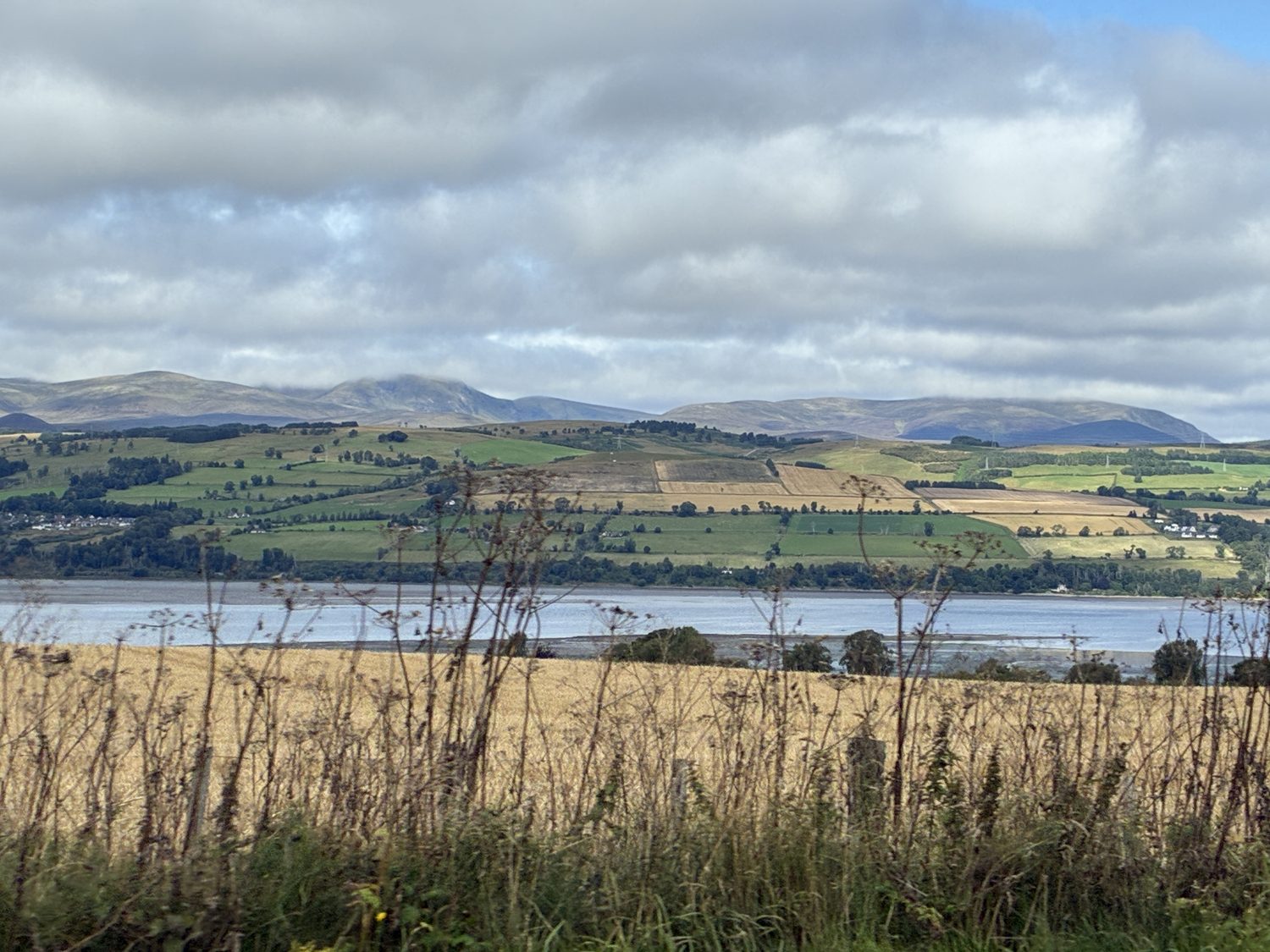
A lot of driving, but also some very nice stops along the way. The scenery was quite different from the dramatic lochs and mountains we passed through yesterday in the north central and western highlands, instead traveling today through the idyllic and peaceful hills and fields of the northeast coast, along the North Sea starting around Golspie. The scenery was wonderful, although lacked the drama of yesterday’s scenic surrounds, and was a pleasant and easy drive, changing to more barren and rugged, and pretty windy and cool, landscape as we neared John O’Groats, the northernmost tip of Scotland and Britain.
The weather was pretty cool today, wth small patches of light rain, and I definitely needed my fleece vest, on top of my sweatshirt and long sleeve button necked T-shirt. At John O’Groats, it was very windy and pretty cold, with that icy wind biting through you, coming in off the North Sea and over the hills. I need long johns before we get to the Faroes, if this is a taste of what’s the come. Brrr. Still, despite that, the weather was on our side, and it was bright, despite often overcast skies. and we haven’t yet needed our rain jackets. But we would much rather have the warm weather that now seems a thing of the past, at least up here.
For the most part, we remained on winding but wide enough roads most of the way, but at times, as we went off the main road, we hit those narrow one lane roads that photos can’t really do justice to. By now I’ve gotten used to them, but still always hoping no-one’s coming the other way (which, nevertheless, they inevitably are).


After leaving Fortrose and the Black Isle and joining the the mainland, our first, and very delightful, stop was about an hour north, at Golspie Burn Waterfall and Gorge, where we took maybe an hour hike in the dense woods, along the Golspie Burn (a small stream or river) and across the many small bridges that criss cross the stream.
What a lovely walk, and much longer than we expected, through the heavily wooded glen, first stopping at the small waterfall formed by the Golspie Burn, a small freshwater mountain stream coming down from the surrounding hills and plunging through the gorge, before eventually flowing into the Moray Firth, the same Firth we’re on in Fortrose.


After leaving the gorge, we headed to Dunrobin Castle, which it turned out was just minutes away. The castle doesn”t actually look like a castle at all, and more like a French stylized palace or chateau , but it turns out the exterior was actually built around the original fortified castle, which was was built into the design, and continues to stand within. The castle overlooks the Moray Firth of the North Sea, and has wonderful views all round.
We didn’t enter the castle as we had a long ride ahead along the coast, but probably spent an hour there walking around the castle and enjoying the scenery around and behind the estate, including the beautiful Moray Firth of the North Sea.


The building dates back to the 13th century, between 1230 and 1275, and the earliest surviving castle was a heavily fortified stone keep (tower) that later generations built around, effectively encasing the medieval castle inside the gigantic Victorian mansion that we see today. Rather than tearing down the old fortress, successive generations of the Sutherland family, who owned and continue to own the Castle, built extensions around and over the original castle. In the 16th and 17th centuries, a high house and courtyards were added around the original tower, and further major expansion and construction happened between 1845–1850. Charles Barry, the architect who designed the Houses of Parliament in London, transformed the estate into a mansion with French chateau-style spires, quadrupling the size of the castle and wrapping the new structure completely around the earlier medieval keep, as well as building beautiful gardens inspired by the gardens of Versailles. The castle overlooks the Moray Firth of the North Sea, and has wonderful views all round.
The castle was the seat of the Earls and Dukes of Sutherland, one of the most powerful families in the Highlands, and because the original keep was preserved inside the additions, the castle is recognized as one of the oldest continuously inhabited houses in Scotland. Of course, like everything in Britain, there is a long history. Because the Sutherlands supported the government, in 1745 Jacobite forces attacked and occupied the castle, but were defeated in April 1746 at the nearby Battle of Littleferry, just one day before they were again defeated, permanently so, at the Battle of Culloden.

The estate is very large, as one might imagine it would be, with some lovely cottages and gardens to the side and rear of the castle, outside of its walled and gated gardens.


We spent maybe 60-75 minutes at the castle, and then off we went along the A9, part of the North Coast 500, which took us almost all the way to John O’Groats. We picked up the A99 for the final 33 mile stretch above Latheron, for a total journey of about 120 miles from Fortrose and at the very top of the country, and after our castle visit only briefly stopping along the way for a bite to eat and a cup of coffee, passing through lovely and pleasant scenery and following the North Sea coastline.


We passed through a number of small villages, until passing through Wick, about one hundred miles north, and about seventeen miles away from John O’Groats, which was the first relatively large town we’d passed through, with a surprisingly large (for the area) population of around 7,000, and certainly bigger than we expected this far north, based on the other small towns and villages we’d passed through on the way. After that, we passed through a couple of other comparatively large towns before reaching the top of the world (John O’Groats). Perhaps these are the towns that serve this otherwise generally isolated community.
Now the scenery was starting to become less pastoral and more rugged and barren. I had expected that sort of scenery most of the way, actually, and was a little surprised to see how gentle, rolling, and green the land around us was on the drive up. Compared to the northern central and western highlands, the landscape along the northeast coast was cultivated and tamer. Then, there we were, at John O’Groats.
The story has it that John O’Groats was named for Jan de Groot, a Dutchman who was awarded the charter to run the ferry across the Pentland Firth from Duncasby Head to the Orkney Islands in 1496. That’s the story. anyway. At any rate, the post office officially changed the name of the village to John O’Groats in 1902.

I’ve been to Land’s End at the other end of the country, at the southernmost tip of England and Britain, about 870 miles south of John O’Groats. It is more rugged, at the edge of steep cliffs that rise from the ocean, with waves crashing into the cliffs. John O’Groats is not like that, although I had expected it would be. It is barren and rugged in its own way, but gentler and less dramatic. No cliffs or crashing waves!


We enjoyed John O’Groats and I was glad to be there, but we weren’t super impressed (at least, I wasn’t). But then we drove to the nearby viewpoint at Duncansby Head, and that was more like it. Getting there meant driving a half mile or a little more on a lane that wasn’t even a single lane. I mean, it was just about the width of the car, without room for anybody to even walk the road if a car was coming.

Duncansby Head, a little over a mile from John O’Groats, is on cliffs dropping into the Pentland Firth, so that was more like it (although still not as dramatic as those at Lands End), and that was more what I was expecting, with powerful and chilly winds helping to fuel the dramatic effect.


Then it really was time to head home. an almost three hour drive back down the coast, and it was after 6 pm by now. Even so, we decided to take the road across the north coast, heading west on the A836 for about 20 miles to Thurso, and then picking up the A9 heading southeast from there, rejoining the coast road south at Latheron, and in that way catching a little more of the NC500 and seeing a little of the northern coast, and it only added maybe 15 minutes to our return journey.
But we just had to stop at Latheronwheel Harbor, soon after we joined the coast road, now heading south. And it was totally worth the stop.


But that really was our last hurrah, and we knew it was time to go. The journey back was lovely, with the southbound view of the same scenery we’d seen on the drive north, and the North Sea to our left, Dusk started to fall around 7:30, but it wasn’t until after 9:15 that it started to really darken, and so our last stretch was in the dark, arriving back at the cottage a little after 10, after a very long but enjoyable day, driving to the very top of the country and back.
Elana had a very late dinner, not a great idea, and not in our initial plan as we had expected to arrive home earlier and eat at one of the small restaurants in town. But a late meal was better than none at all. We decided to figure out tomorrow tomorrow, but definitely not a 10 hour, or even an 8 hour, driving day, and dinner in town. And then it was time for bed.