To the Isle of Skye and Back.
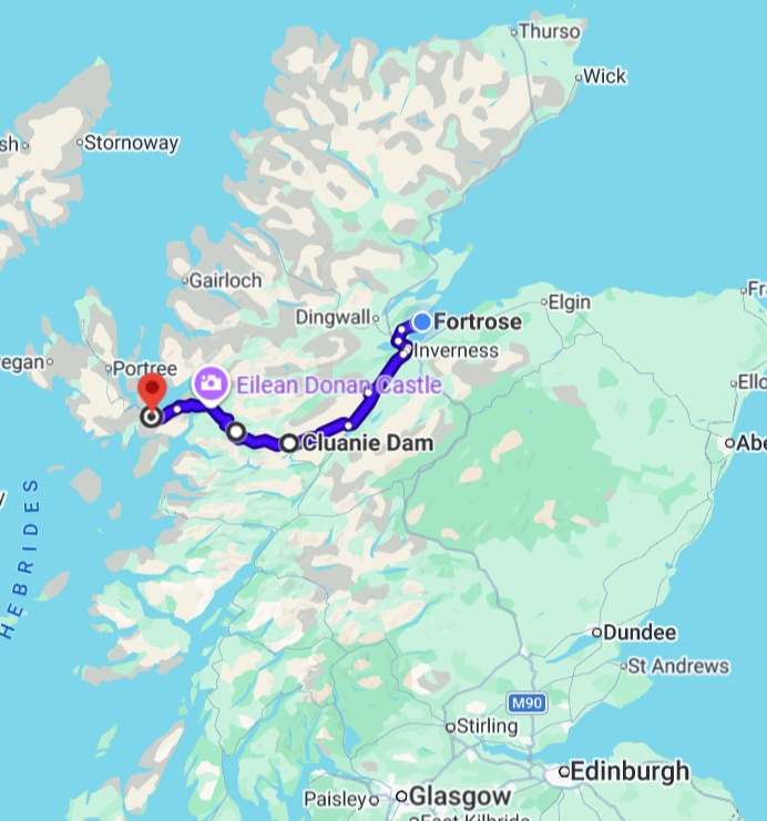
Wow, what a day! We got off to a slow and late start, but that was fine, and we took care of some things that needed taking care of. For one thing, . Elana slept solidly until almost 10, which was great, as she really needed to catch up on missing sleep. Then we headed into the village of Fortrose, which is a small place with just one high street, a couple of minutes walk from our cottage, and bought some basics at the local Co-op and a small bakery, as well as some coffee for Elana. After all that, it was about 11:45 or noon by the time we left for our drive to the Kyle of Lochalsh and then onto the Isle of Skye. And what a drive!!
The weather here is chilly, although at times borders on the cool end of warm, with patches of light, and sometimes chilly, rain throughout the day and evening. We were lucky with the rain though and never needed to resort to our rain jackets. I can only imagine it will be the same, but far more so, in the Faroes. I’m not sure I have enough warm clothing in that case (but that’s a bridge that lies ahead, and a story yet to unfold)
We had no actual plans for the day, other then driving to the Kyle of Lochalsh, passing through the north central and western highlands, and then onto Skye, one of the islands of the Inner Hebrides. We just figured we’d see some lovely scenery. We did!


Lovely scenery? That’s a serious understatement. What we saw, as we headed west, away from the Inverness area, was scenery that moved from picturesque, lovely, and beautiful, to beautiful, incredible, dramatic, and stunning, with wow moment after wow moment. Taking the A82 south from Inverness, we passed along the western shore of Loch Ness, which of course is very touristy (us included), although we didn’t stop, other than for a few photos along the way.
Loch Ness is massive, a long finger lake, It’s 23 miles long, with an average width of about a mile (although almost two miles across in some spots), with a maximum depth of over 750 feet. By surface area, it’s the second biggest loch in Scotland, next to Loch Lomond, but the largest in volume, and contains more freshwater than all the lakes of England and Wales combined. I’m sorry we didn’t stop and spend some time there, but we were on a mission to get to Skye, and it was going to be a long day, especially as we started out rather late in the day. As it was, we didn’t get back to Fortrose until around 8 pm this evening.


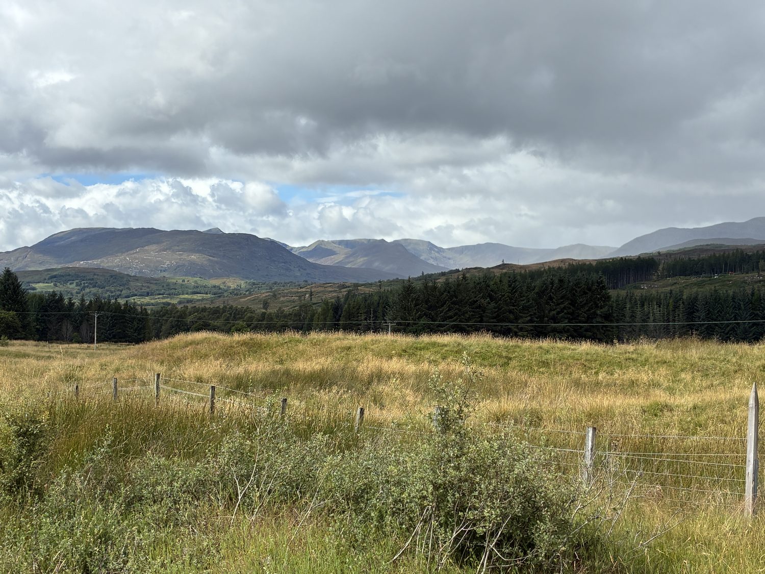
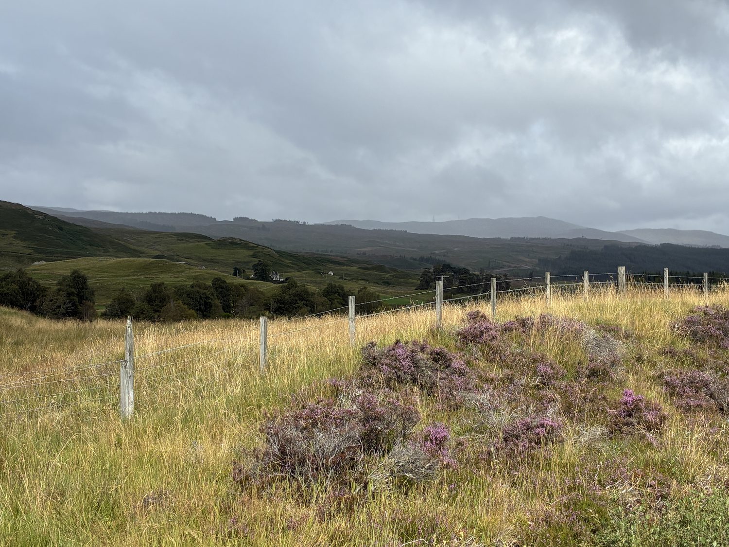


The names of the various area and villages we passed through were both both lovely and dramatic, but not easily pronounced by us; actually, in many cases we had no idea of the pronunciation. After Loch Ness, where we didn’t see the monster (but in all fairness, we weren’t looking), we continued on the A82, passing Drumnadrochit toward Invermoriston, where we picked up the A887 through Glen Moriston and toward Loch Cluanie and the Cluanie Dam, and by now not only were we in stunningly beautiful country, but also passing through increasingly dramatic and massive mountains. The A887 took us to the A87 through Glen Shiel and spectacular mountains, including the Five Sisters of Kintail, and we continued down Glen Shiel toward Loch Duich to Eilean Donan Castle at the head of Loch Duich. yet another wow moment.


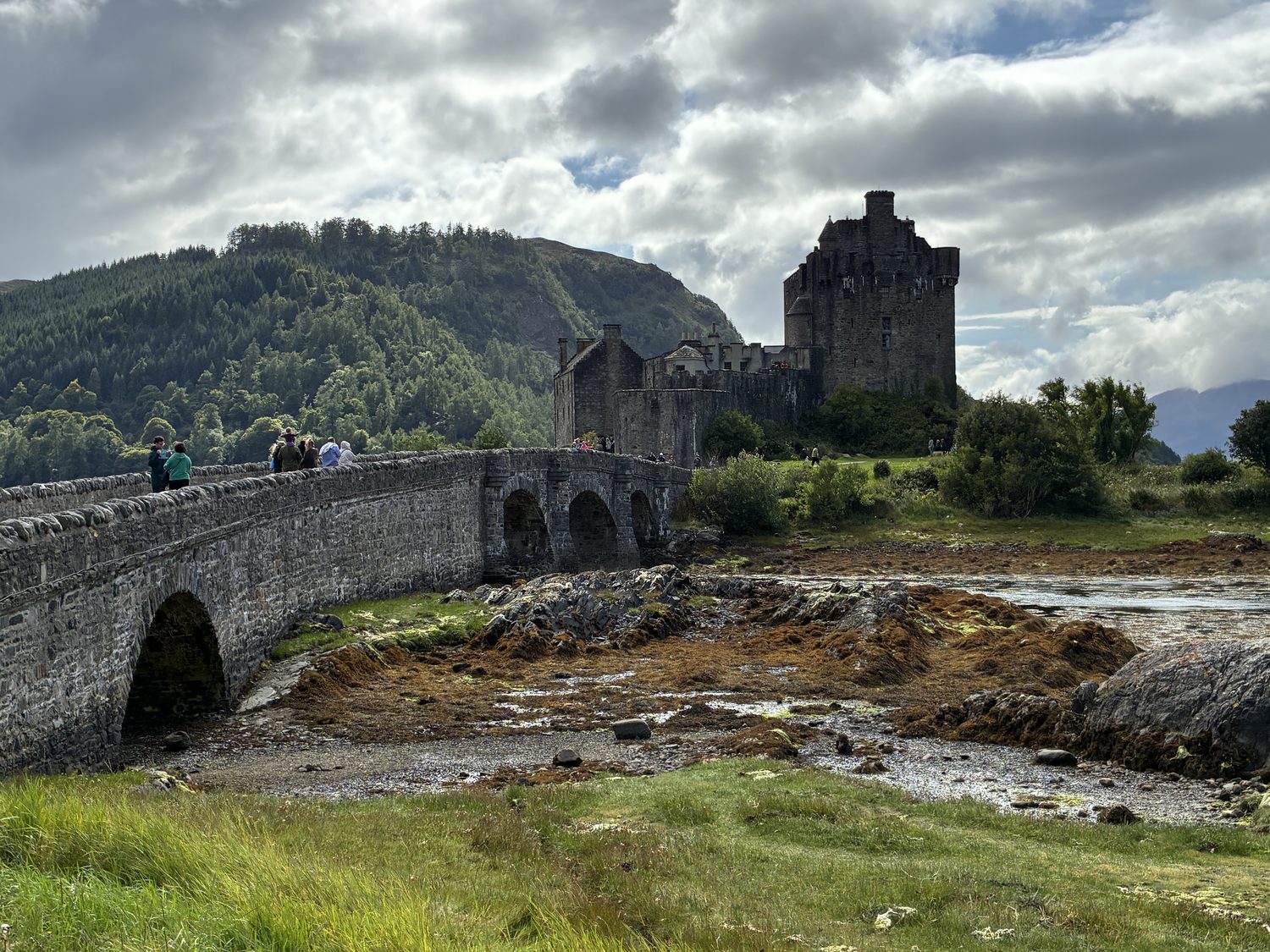
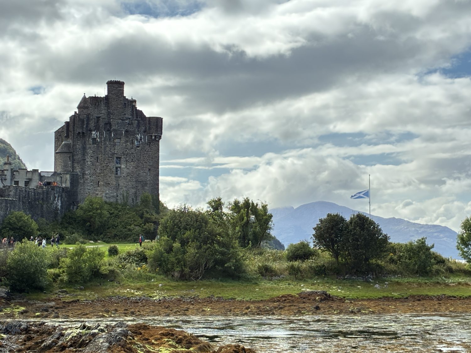
We stopped at Eilean Donan Castle, walked a little and grabbed something to eat, but didn’t visit the castle, as that wasn’t our plan, but on another day, with more time, that would have been a nice thing to to do. Eilean Donan is one of the most famous and photographed castles in Scotland, featured in numerous films and strongly associated with the classic Scottish Highland castle – for good reason. It and its location are spectacular, and the castle sits on a tidal island where three saltwater sea lochs meet: Loch Duich, Loch Long, and Loch Alsh, with the mountains of Kintail behind it. Of course, it has an incredible history, dating back to the early 1200s, when a castle was first established here as a defensive stronghold against Viking incursions.



From Eilean Donan, we continued along the A87 toward Kyle of Lochalsh, a small village just a few miles west of Eilean Donan, and the gateway to the Isle of Skye, and across the Skye Bridge we crossed. At this point, we really had no plan at all, except to drive onto Skye and get a sense of it. I was here in 1981 with Bev and Hilary, but remember very little about Skye, including what route we took to get here or the island itself, other than remembering it as stark and quite undeveloped. That’s changed, and it has become a significant destination for visitors and quite welcoming. It wasn’t when we visited in 1981 though, before the Skye Bridge opened in 1995,and we took the ferry over Loch Alsh from Kyle of Lochalsh to Kyleakin, the small village on the other side of the Loch. Back then, I remember the village as uninviting, in which we clearly felt like unwelcome strangers, but today it looks lovely and very inviting.
The Isle of Skye has a long and turbulent history, involving Gaelic clans, Norse settlers and Vikings, clan battles, and the Jacobites,, not to mention prehistoric Skye, where people lived for thousands of years, with prehistoric monuments, standing stones, and burial sites still remaining. From around the 9th century, Norse Vikings began settling Skye, and it remained under Norse rule until the 11th century. By the 13th century, the Scottish Crown had asserted control over the islands, with two major clans on Skye that exercised enormous power.
Skye became particularly famous because of Bonnie Prince Charlie, who attempted to gain the British throne after his grandfather, James II, formerly king of England, Scotland and Ireland, was removed in 1688. After the loss of the Jacobite army in 1746 at the Battle of Culloden, near Inverness, after spending months hiding in the Highlands while government forces searched for him, Charlie, age 25, fled to Skye, with the help of Flora MacDonald. Disguised as her Irish maid, “Betty Burke,” he crossed to Skye in May 1746, where he stayed just a short while before eventually reaching France, without regaining the throne, and died in Italy in 1788. Even though he wasn’t in Skye long, he is very much associated with the Isle. The famous “Skye Boat Song” commemorates his escape to Skye, which I remember well from primary school, as I imagine does every kid who grew up in Britain during that period. “Speed, bonnie boat, like a bird on the wing. Onward, the sailors cry! Carry the lad that’s born to be King over the sea to Skye.”
During the 18th and 19th centuries, many landowners reorganized their estates to make them more profitable, often replacing tenant farming communities with sheep and clearing the lands, and families were evicted from their homes, often forcibly. Skye was particularly affected, and local Gaelic communities suffered enormously. After the Highland Clearances, as they were known, Skye became a land of small crofts (small family farms) and fishing, and the island remained largely Gaelic-speaking well into the 19th and 20th centuries. It was improved transportation that gradually transformed Skye, with the railway reaching Kyle of Lochalsh in 1897, connecting the mainland via the Skye ferry, and eventually the Skye Bridge, opened in 1995. Today, Skye is one of Scotland’s major tourist destinations, known for its mountains and dramatic coastal scenery, and its overall beauty.
We were running out of time, as it was around 5 by the time we crossed the Skye Bridge, still on the A87, passing by Kyleakin and Breakish as we drove southwest, passing the dramatic waters of the north shore of the Island and the Inner Sound of the Sea of the Hebrides, part of the Atlantic, driving only about eight miles in, and stopping in Broadford.


We could easily have kept going, and it was difficult to stop there, but it was well past 5, and we had a 2½ (plus) hour drive back to Fortrose. The area is beautiful and stunning, with some of the most spectacular mountains in Scotland. Broadford, where we stopped, is dominated by the Red Cuillin mountains, with the Black Cuillins visible in the distance, and the massive Beinn na Caillich mountain west of the village, its peak shrouded in clouds. The best single way to describe the scenery is “phew.”


We took an inland route back, passing from rugged and dramatic mountain scenery to more pastoral sheep covered fields and rolling hills as we neared Inverness, and then onto the east coast of the Black Isle as we reached Avonch and then Fortrose, arriving at the cottage a little after 8 pm.
After driving back over the Skye Bridge, we headed northeast, toward Plockton and Strathcarron on the A87, passing through the Loch Carron/Strathcarron area on the A890. We started for Plockton, a small village off the main road that we would have liked to have seen, but it was another of those very narrow backroads, and although not far in miles, was slow driving and probably a 30 or 40 minute round trip, and time was not on our side at that point. So we turned back to the main road, which itself was not too “main,” as much of the road was single track for many miles, with pullover spots for oncoming vehicles to get by. But we did get some amazing views as we were high into the hills and overlooking the land and waters below and mountains in the distance, passing Loch Carron, a saltwater sea loch flowing into the Atlantic. From there, we followed the lovely country roads from Lochcarron, the village along the Loch, eventually taking us through the very scenic Wester Ross, where the landscape was now very different than the Cuillin mountains around Skye, with its much more concentrated, steep, and jagged mountains.


Now in Wester Ross as we headed back toward the Inverness area, the surrounding scenery was open moorlands, wide glens and valleys, and sloping mountains rising on both sides of the road, with broad views across the Highlands, with few settlements along the way, other then small farm houses scattered here and there. Finally, we picked up the A9 toward Avoch, and from there it’s just a few miles along the east coast of the Black Isle to Fortrose.


Arriving home a little after 8, we made some dinner, or really heated up some dinner from the food we bought this morning. The Airbnb is really great, but the instructions on how to use the cottage are not, so it took a short while to figure out just how to use the appliances, so we didn’t actually eat until around 9. Then some hanging out time, time for blogging, and to bed. Tomorrow, we’re planning on traveling most along the east coast of the North Sea to John O’ Groats, the northernmost point in Scotland and Britain.
For now, goodnight.
