Wall, the Black Hills, Needles Highway, and the Badlands of South Dakota.

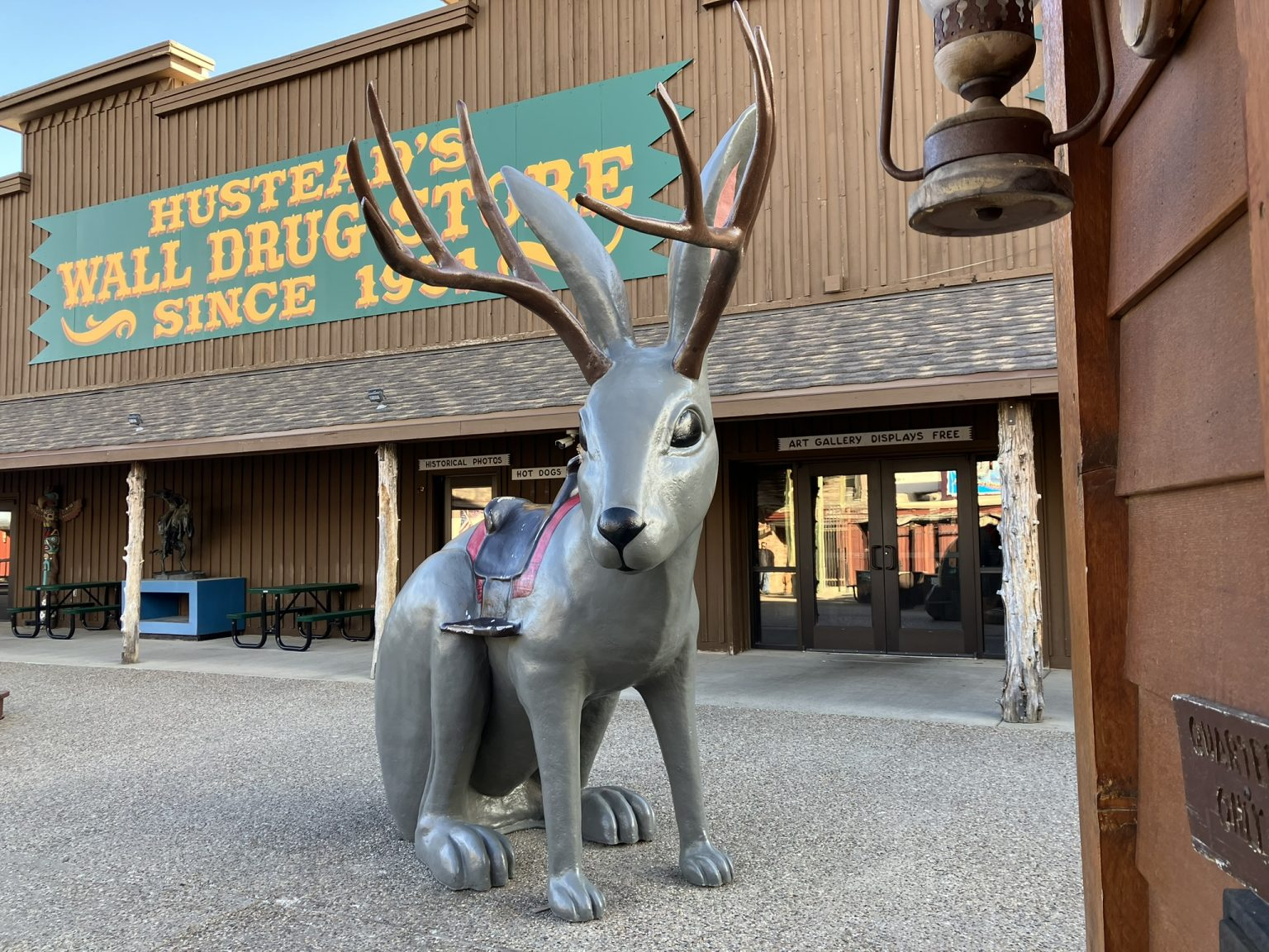
Another very nice day of driving and visiting, starting with the town of Wall itself, and actually Wall Drug, which essentially seems to be Wall, from what I can tell. I mean, Wall Main Street is mostly taken up by the Wall Drug building, and Wall Drug seems to have various business offshoots throughout this mall town. I mean, even the Welcome to the Town of Wall sign says “Home of Wall Drug” right on it as its main feature.
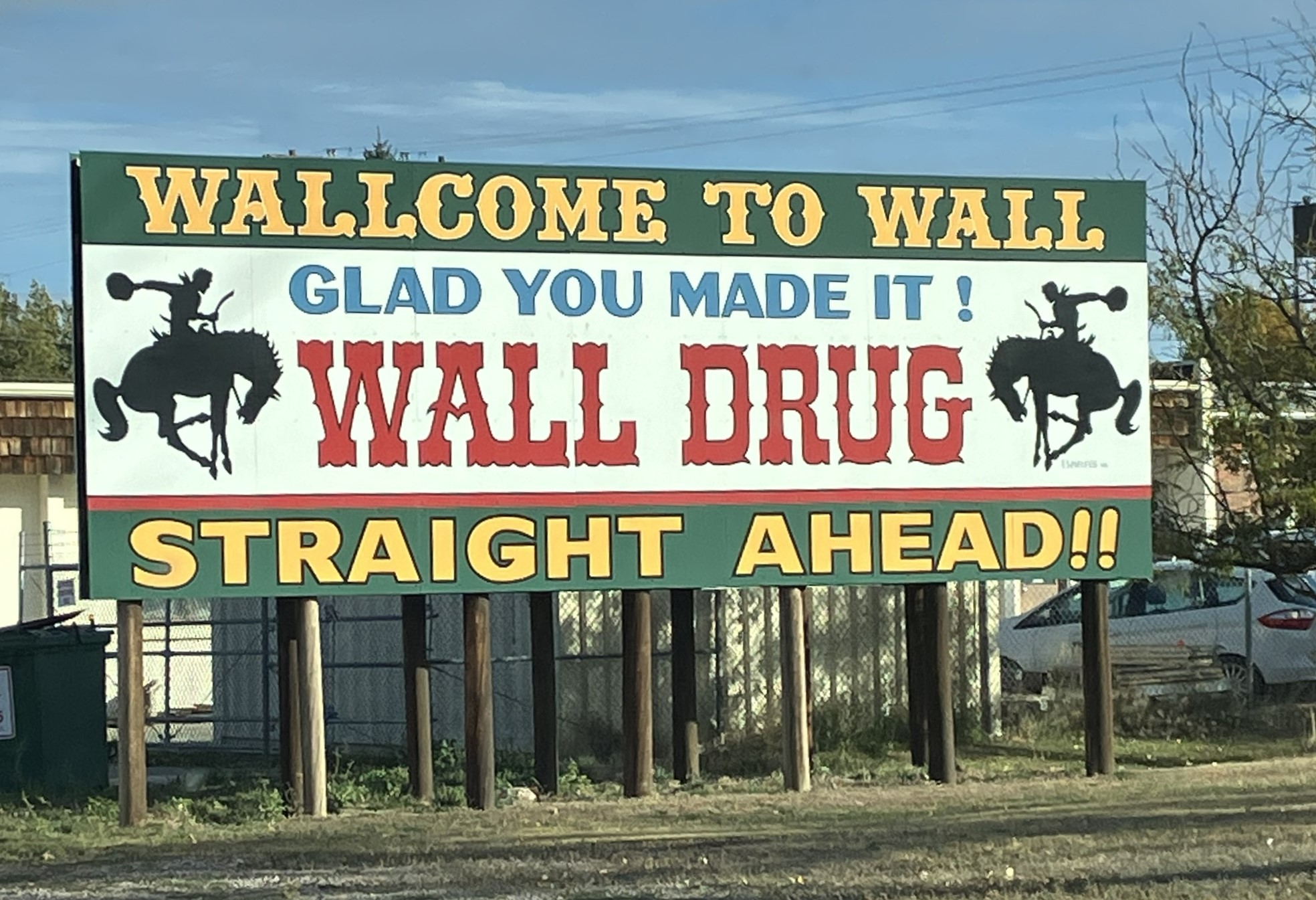

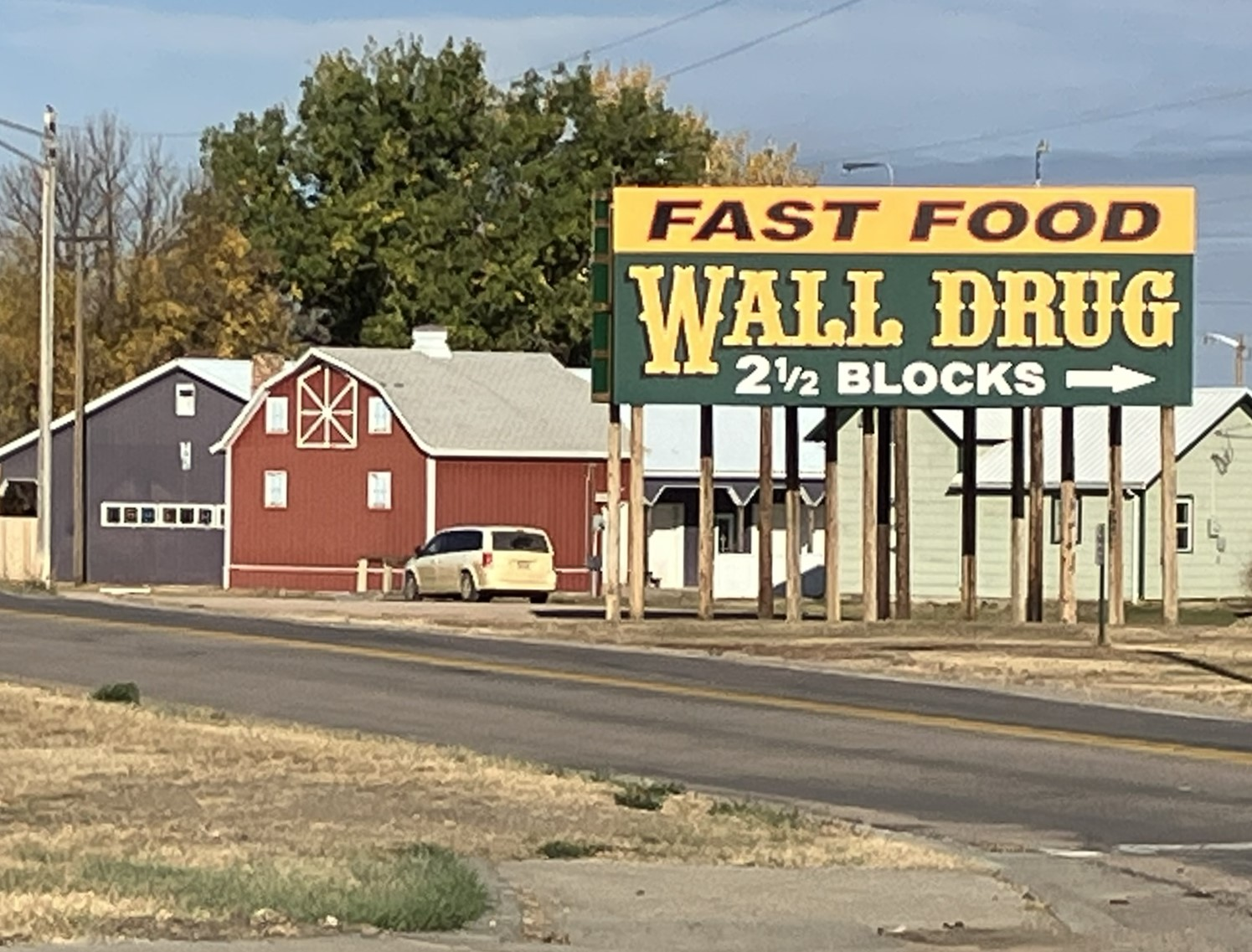
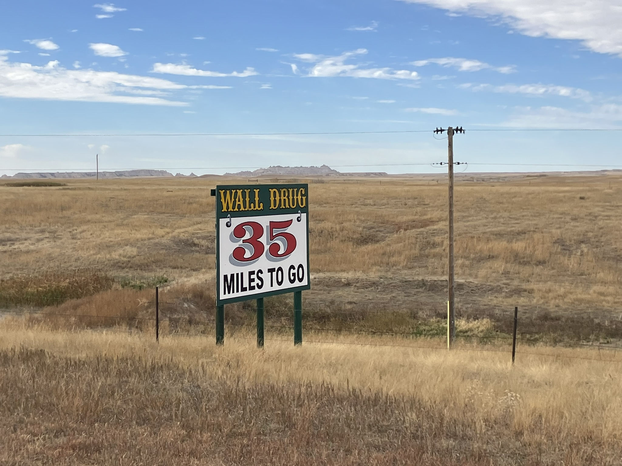
Wall Drug is famous because it’s famous, and it’s famous because of the hundreds of signs posted along interstate 80 and interstate 90 for hundreds of miles, like the one in the picture below; in fact, I think the furthest sign is almost 400 miles away.
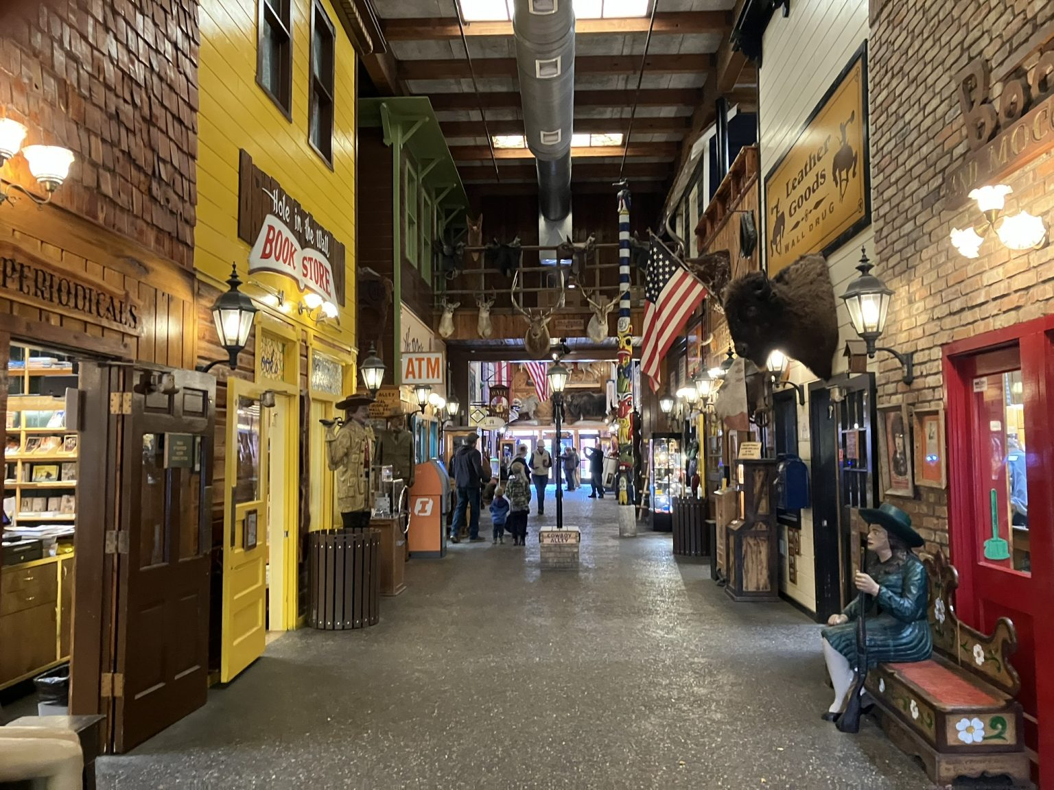
Wall Drug is housed in a big, big store that literally takes up half of Main Street, and includes all sorts of different departments. In fact, it reminds me of the Yankee Candle store, although not as big or ornate, and without the candles. Like Yankee Candle, the store itself is an attraction, and visiting the store is an experience, which, in both cases, is the intention.
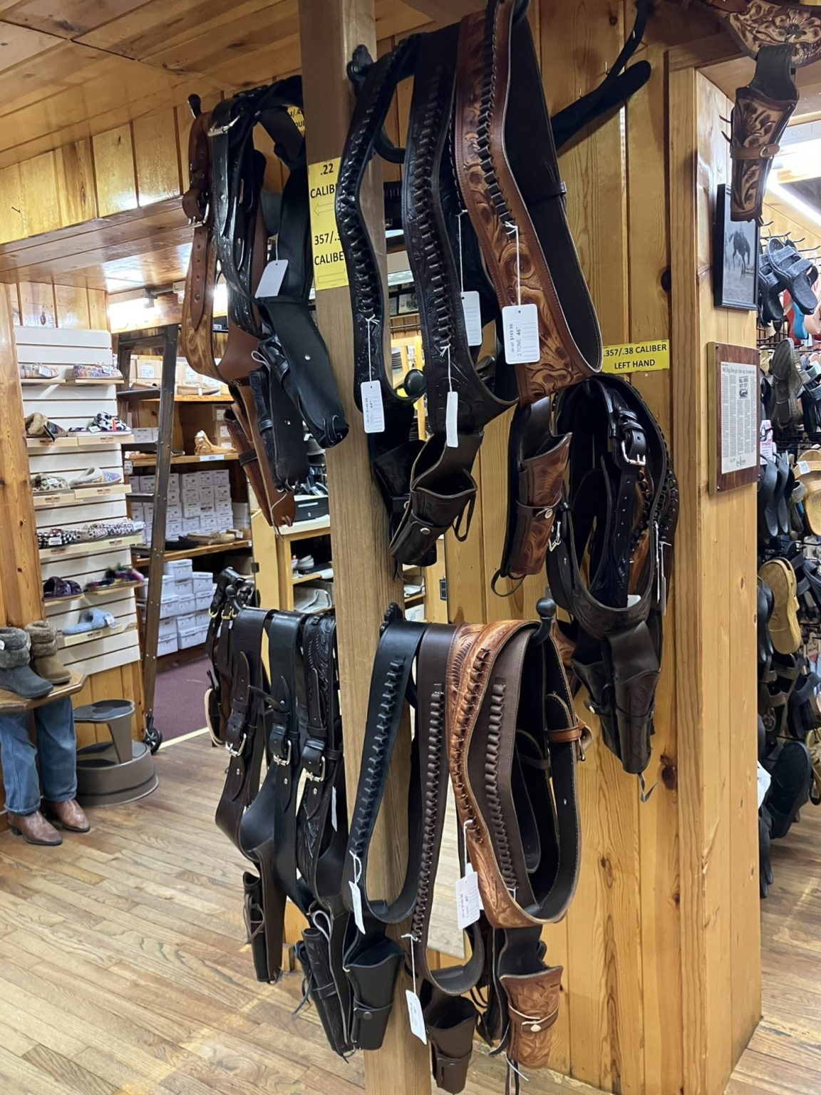
Wall Drug has a cafe (maybe more than one) and multiple departments, with clothing, shoes, jewelry, cowboy hats, cowboy boots, fast food, sit down meals, candy, gifts… you name it. I think it even has an actual drug store.


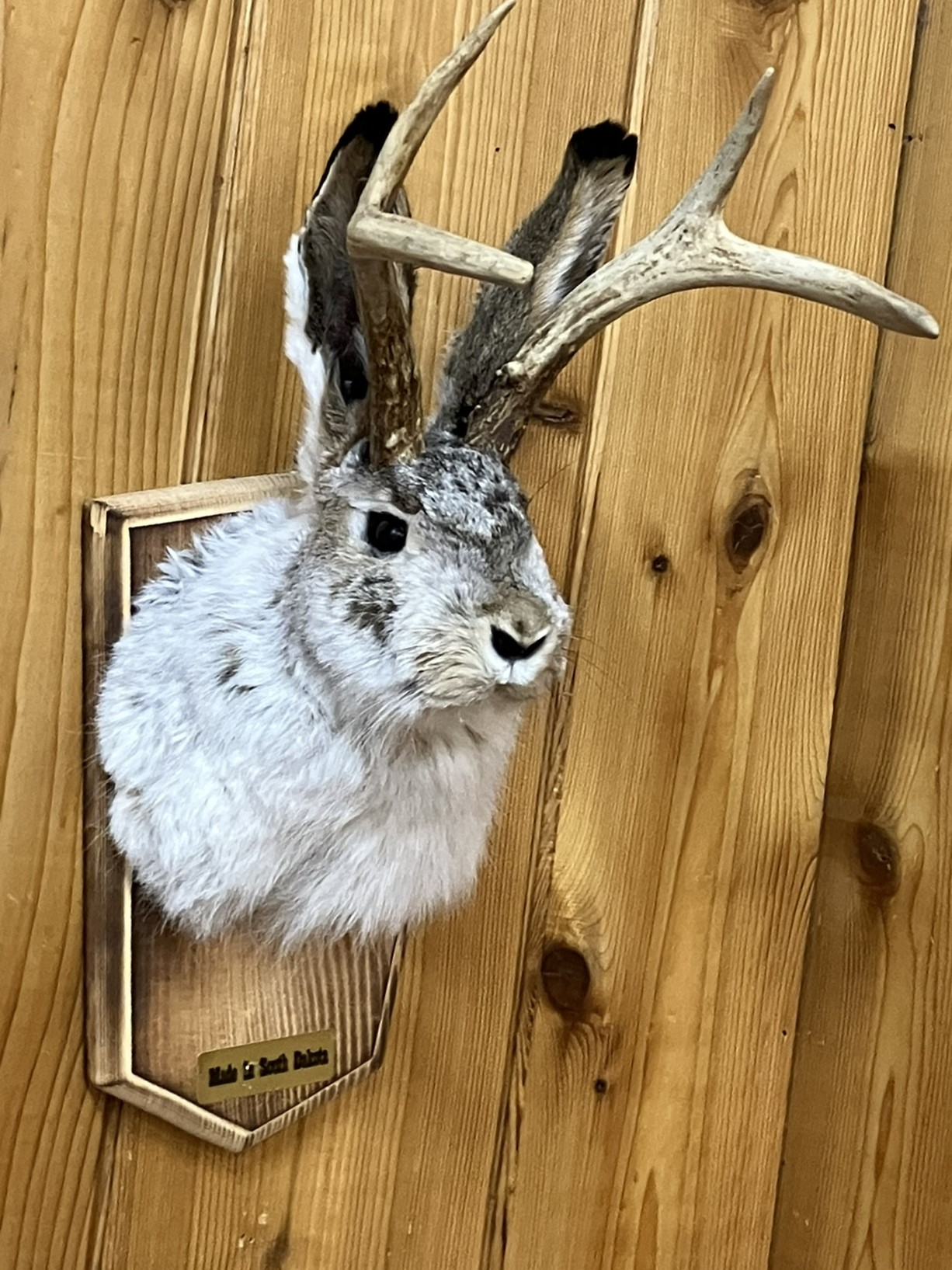
And, at Wall Drug, I learned that Jackalopes are real, after all. Of course, I always knew that. I just couldn’t prove it — until now.
There’s really not too much to see in Wall (or Wall Drug, for that matter). So, after deciding to stay here another night, I headed back west toward the Mount Rushmore area (although I didn’t visit Mount Rushmore again), in order to visit Custer State Park, and also re-visit the Peter Norbeck Scenic Byway, as well as some of the other scenic highways out that way.
Lovely day, but when I left this morning it was just 48 degrees, although somehow it felt okay. The day never got passed the mid-50’s, but was clear and crisp, and very nice out. Much of the time, it was sweatshirt weather some of the day (the days of shorts and sandals are mere memories now), although, despite being in the 50’s, during the early afternoon it was more than warm enough to take off that sweatshirt.
It’s about 80 miles from Wall to Custer State Park, and I took the most direct direct route I could to get there, heading along I-90 west and then south on local roads, wanting to get there as quickly as possible as I planned to take a more meandering route once there, as well as on the way back to Wall later in the day (which I did).

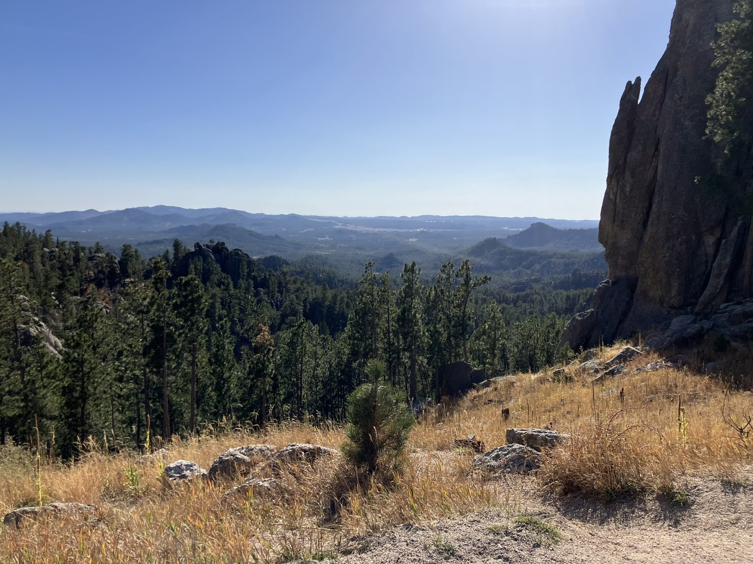
The park is lovely, with mixed landscapes that vary from flat roads running through flat or hilly prairie land, to tree-lined country roads and pine-covered mountainsides with curving mountain roads. As I drove through, I kept leaving the park, seeing local ranches and farms, and then re-entering it, and I’m not quite sure where the boundaries of the park are. There is a fee, so in addition to an actual gated entry point, which I came in through, there are many automated pay stations throughout, at those many points where you leave and re-enter the park, without any clear boundary. That’s how I knew I was in and out of the park.
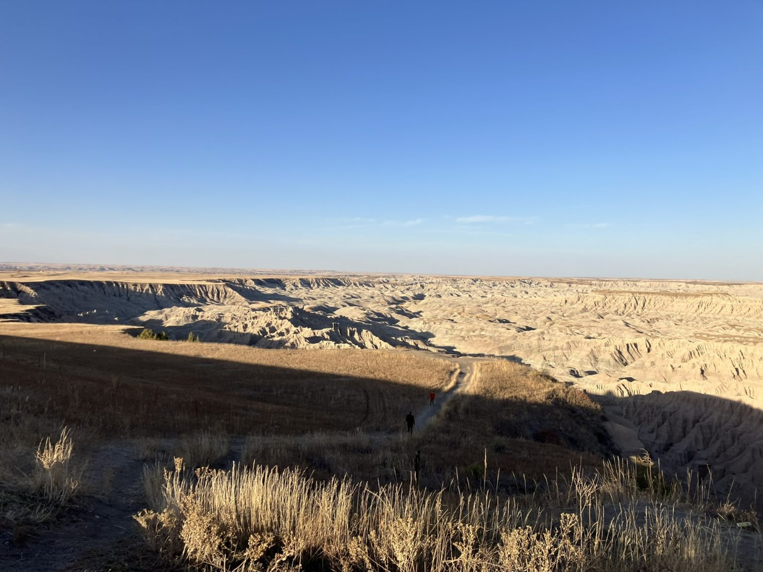
In fact, the boundaries seem vague. One minute I’m driving in the park, the next I’m not, then I am again. Maybe if I had an actual map of the park it would have made more sense, but I didn’t, and as usual was just winging it as I went along, although today I did have a sense of the places I wanted to see there. At any rate, it’s a big park, about 71,000 acres, which makes it one of the largest state parks in the U.S., and so there are many different parts to it, and changing landscapes within it. It also has a lot of wild life, including bison and bighorn sheep, although I didn’t see any. However, although I was in the park for some time, I really only saw a small portion of it.
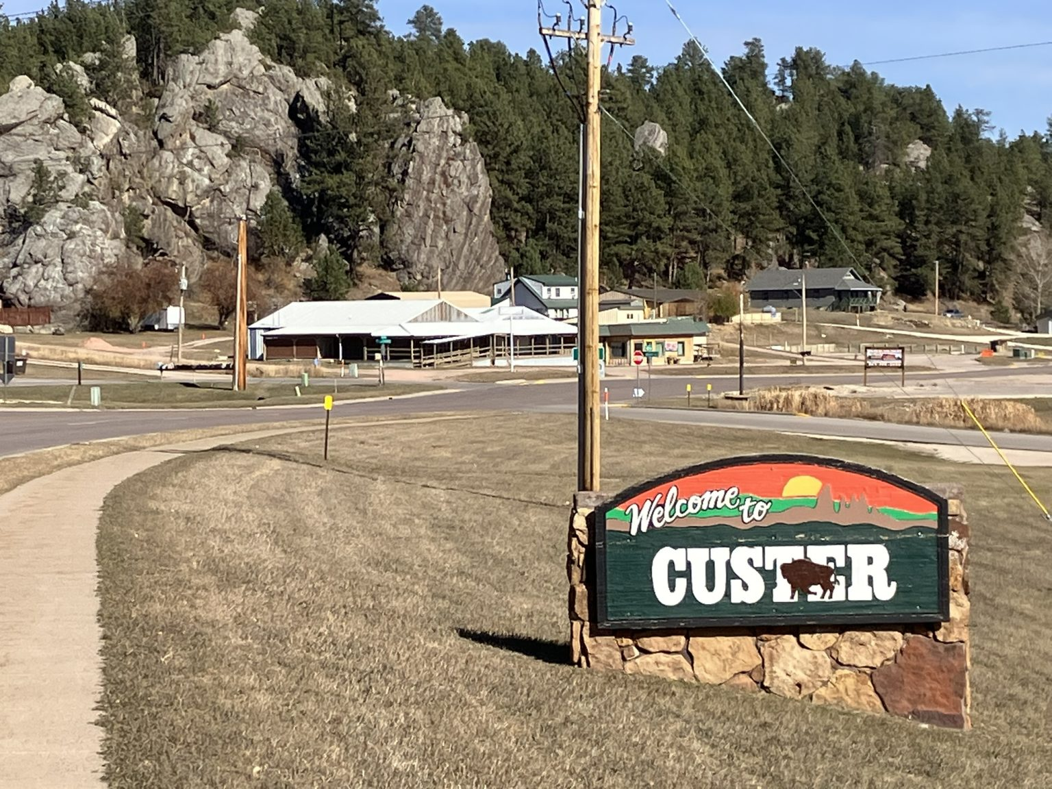
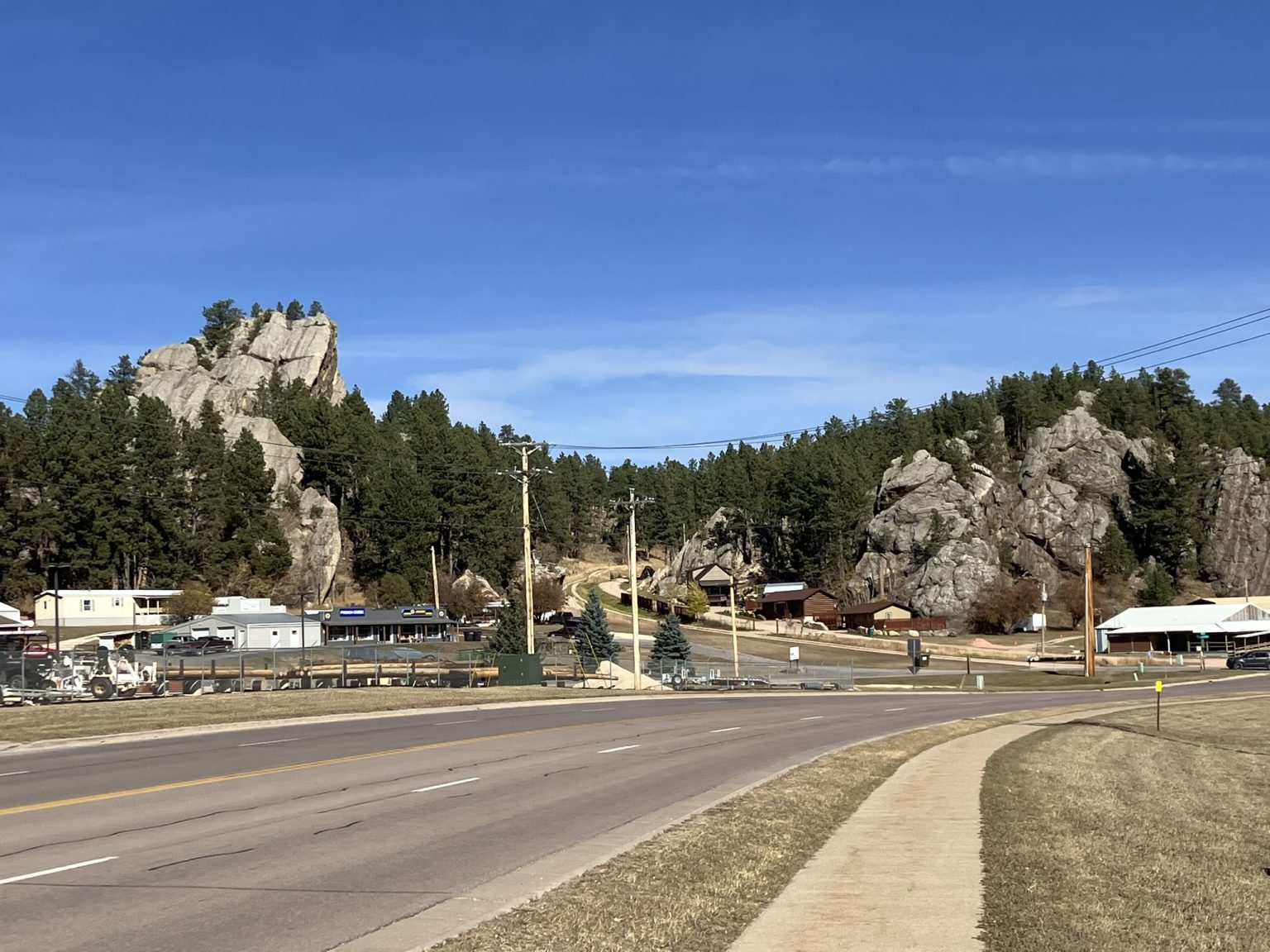
After driving through the park for a bit, trying to get oriented, I left the park for a while, as I wanted to visit the nearby town of Custer. It’s a small town, like most around here, of around 2,000, featuring, also like many of the small towns in the west, a drive/walk through main drag, lined with stores, some of which are local and many aimed at tourists and those passing through.


I didn’t stay in Custer too long after driving and walking through the town, and instead headed back to the state park, and Sylvan Lake, in particular. On the way, I passed Crazy Horse Mountain, and briefly stopped to see the Crazy Horse Memorial, which is a bust of his head carved into the mountain (don’t mention Mount Rushmore). I didn’t enter the memorial, as I just didn’t have enough time, but just through to the main entrance, close enough to get a couple of photos.
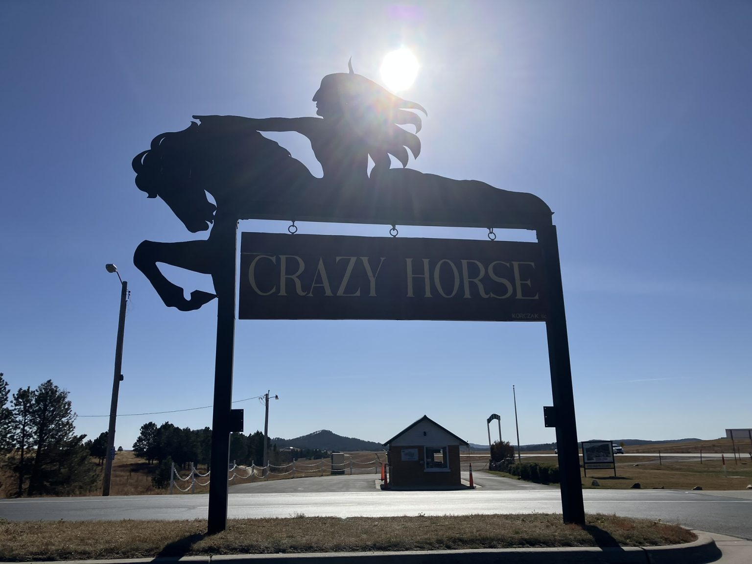


Crazy Horse was a leader of the Oglala Lakota people, and died at the hands of the U.S. military in 1877, at age 36 or 37. The carved monument is incomplete and has been under construction since 1948, and still a ways from being completed. I guess the intention is to have him portrayed riding his horse, but so far there just seems to be a bust of his head, although perhaps more has been completed and I couldn’t see it from where I was.
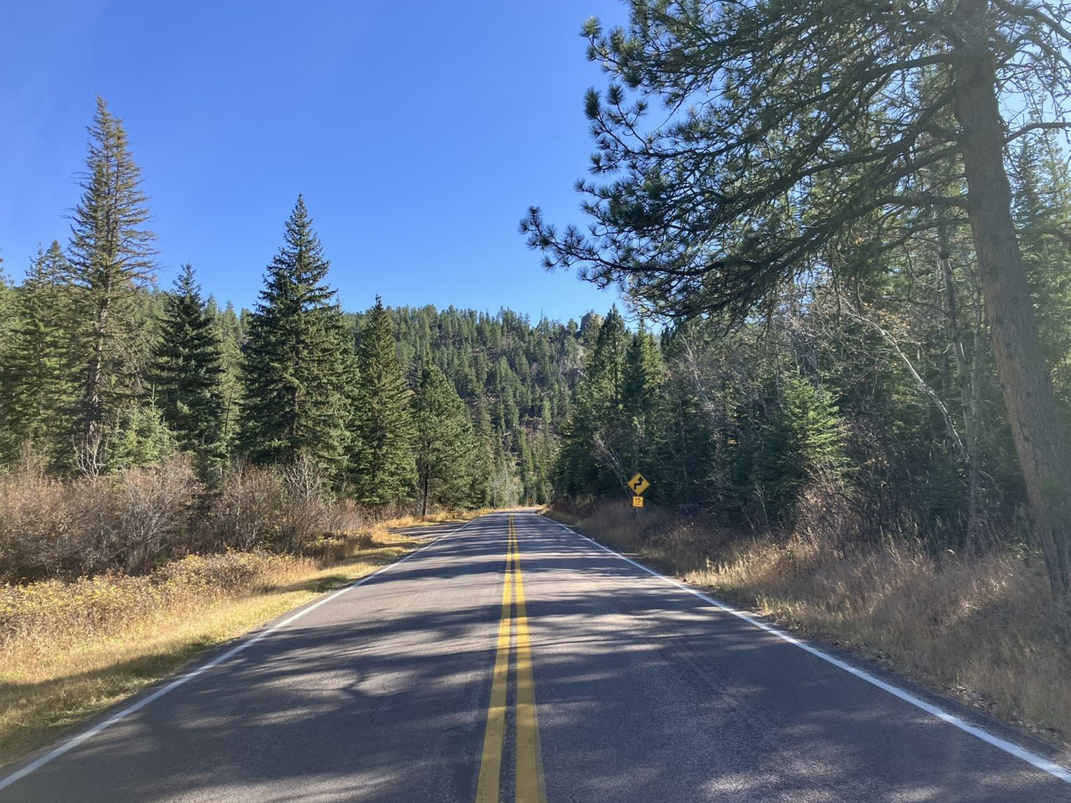
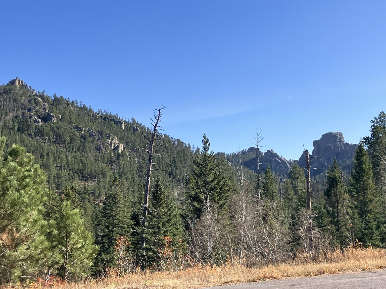
Then back onto the Peter Norbeck byway, which took me back into Custer State Park. It’s another meandering country, and sometimes mountain, road that is 68 miles long, and includes routes 87 (Needles Highway), 89, 244, and 16A (Iron Mountain Road). What a road.


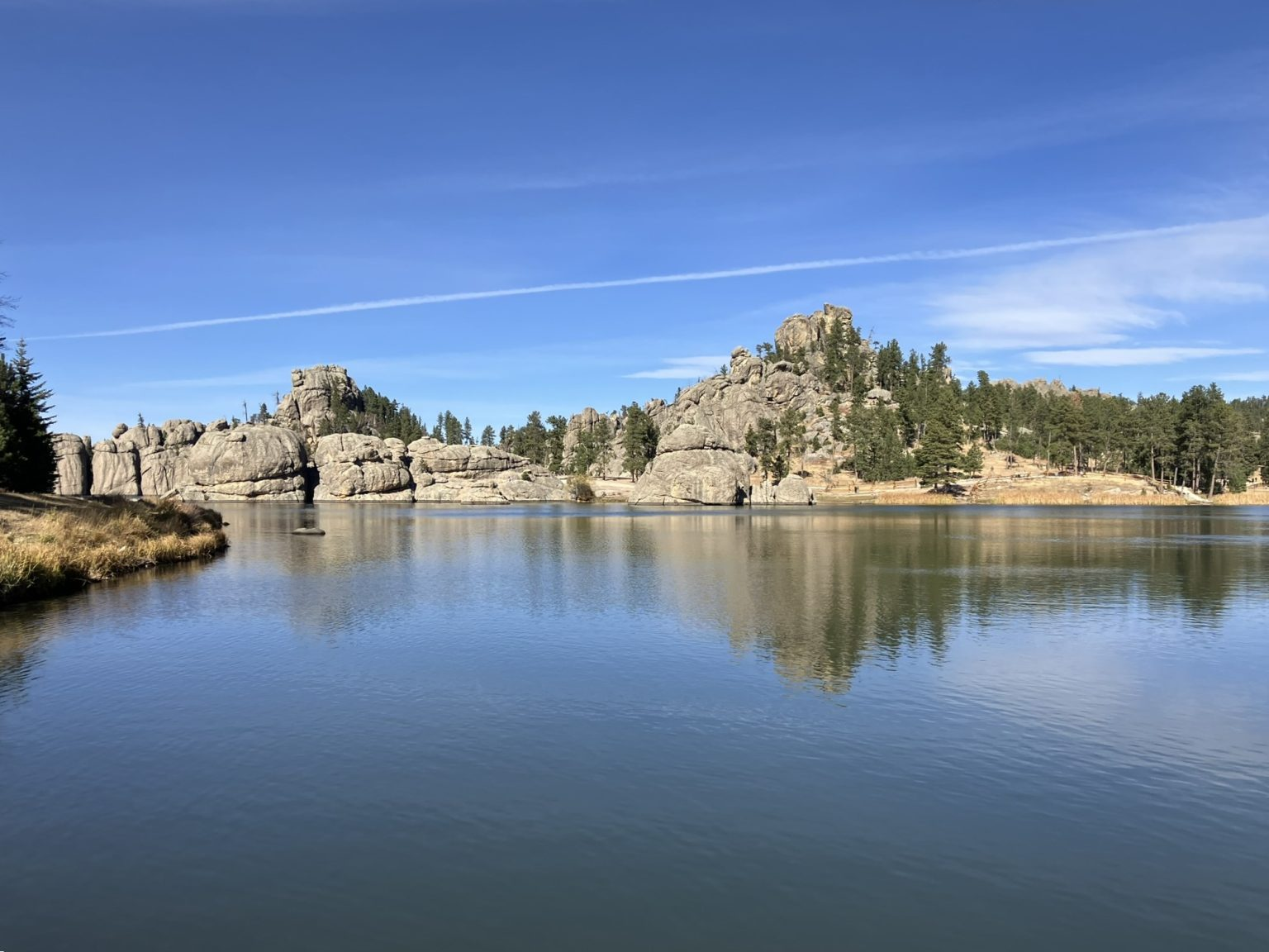
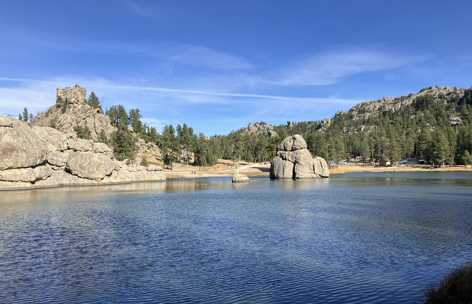
The scenic byway (and it is scenic) took me back to Custer State Park, where I headed to Sylvan Lake, about 17 acres, and one of five lakes in the park. Talk about serene, with beautiful rock formations all around the lake and in it. Here I finally took a good walk around the lake, around 3 miles, and clambered onto some of the rock formations. Serene, tranquil, lovely, and warm (even though only in the 50’s).

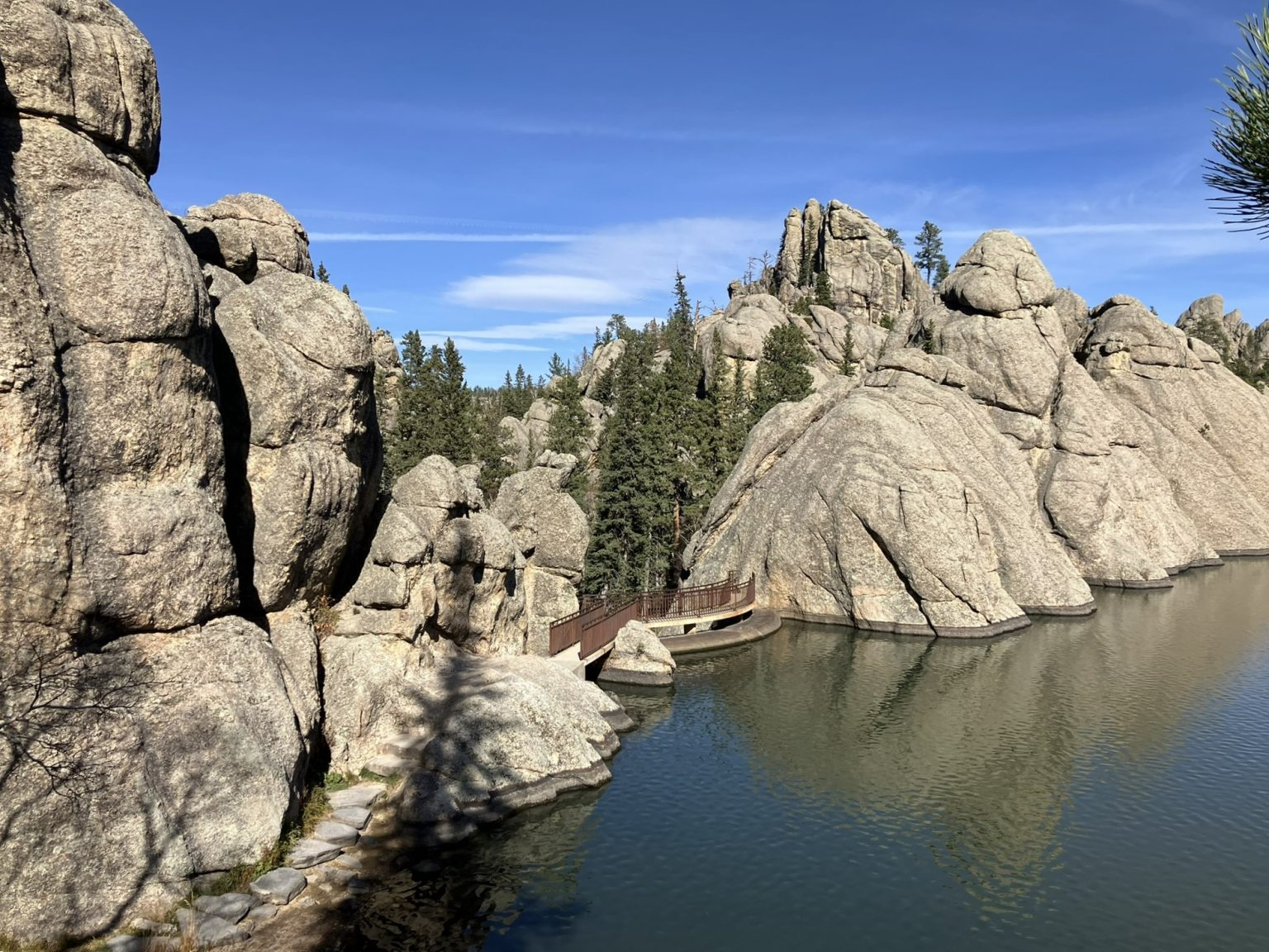

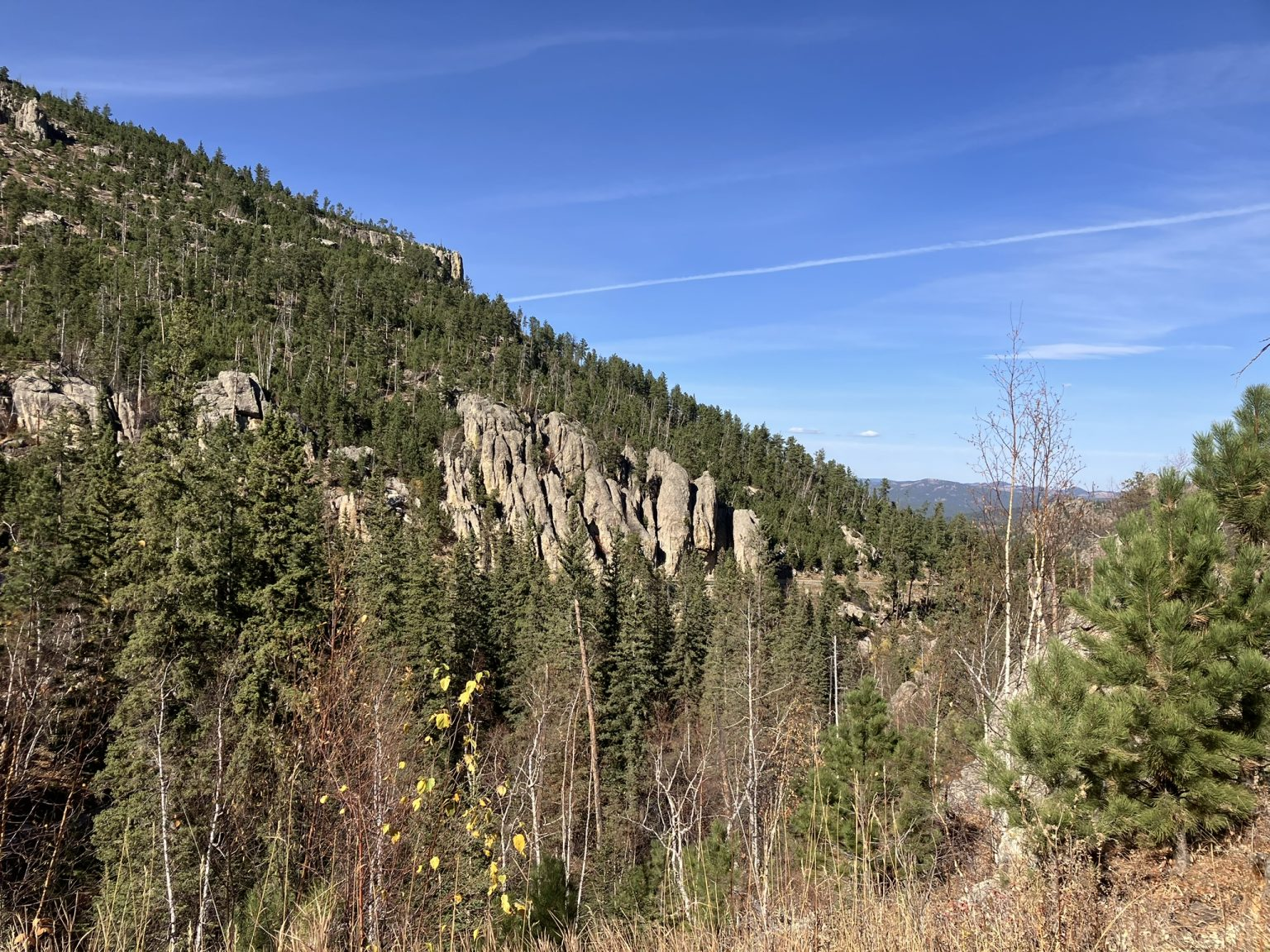
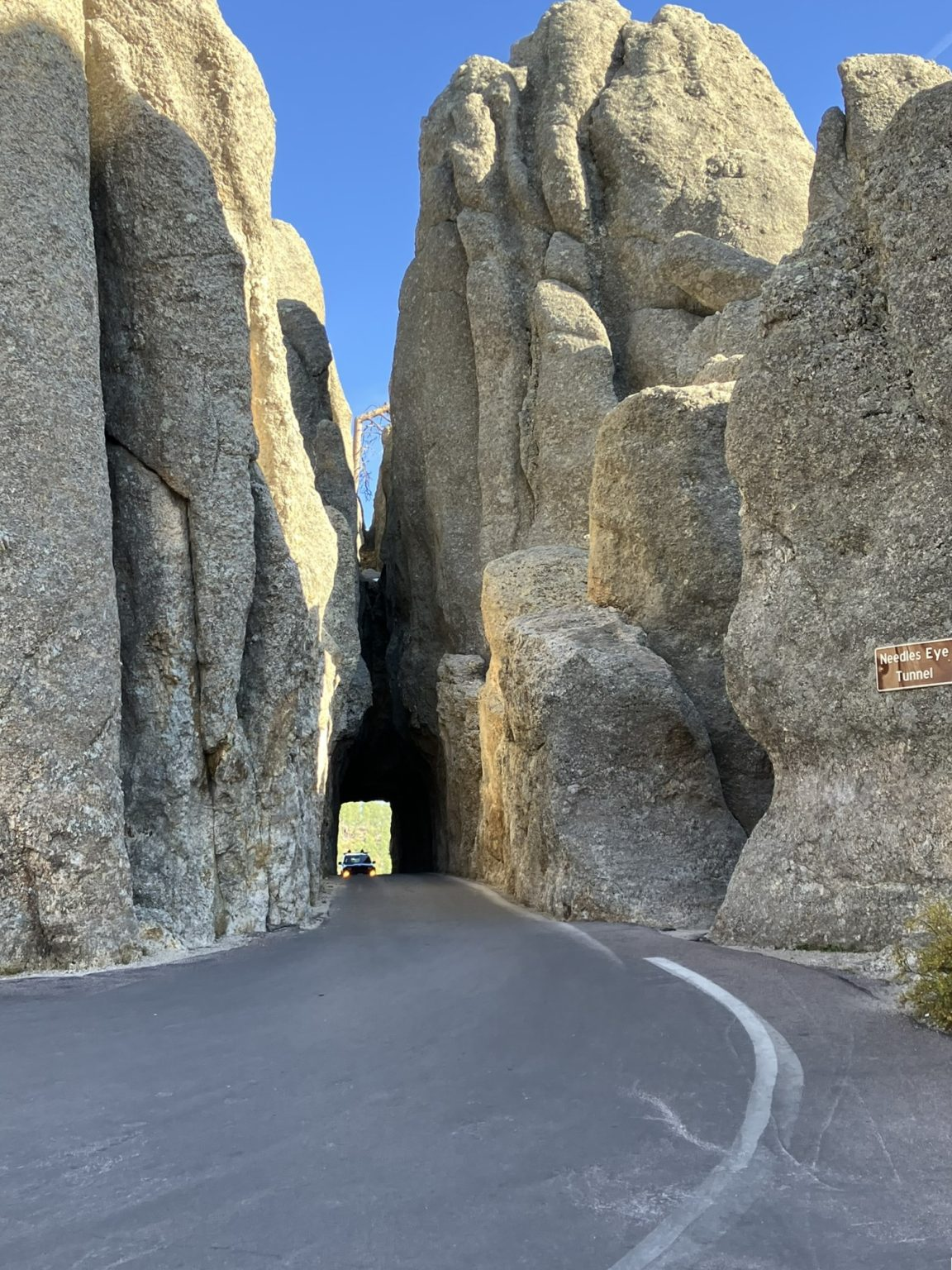
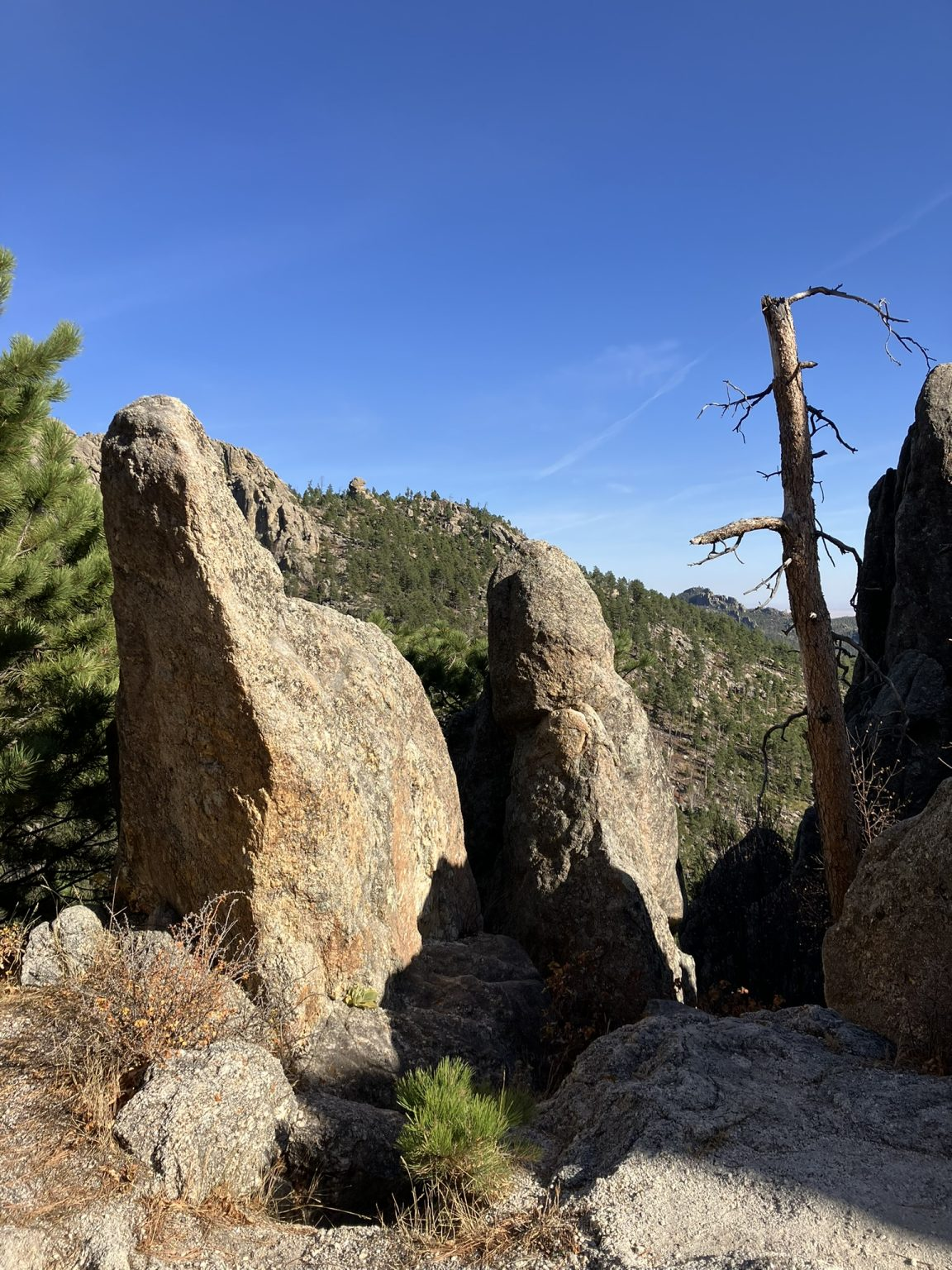
From Sylvan Lake I continued onto Needles Highway, which is actually part of the Peter Norbeck byway. Norbeck was a South Dakota Governor and Senator who raised money and personally scouted this area in order to build Mount Rushmore and develop this entire area. Needles Highway is again spectacular, and is a 14 mile winding mountain road that passes through incredible needle-like rock formations, with wonderful views and trails.


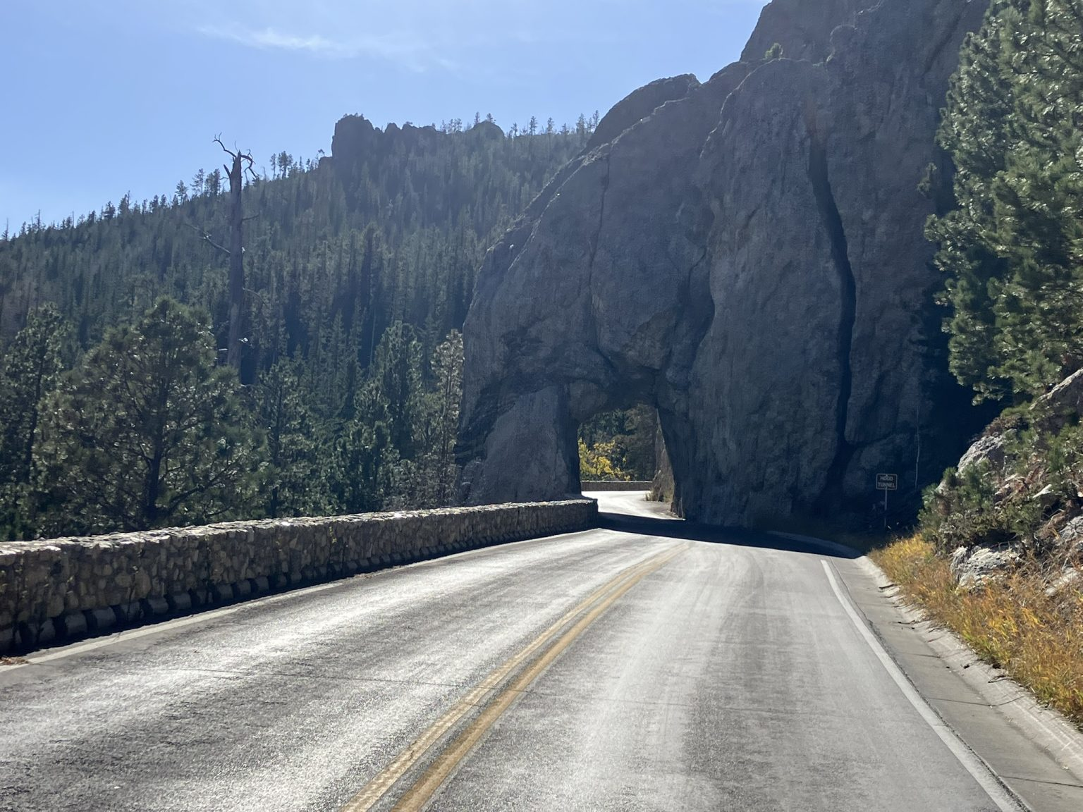
Needles Highway also has a number of rock tunnels, none long but some slightly longer than others, blasted through the mountain.

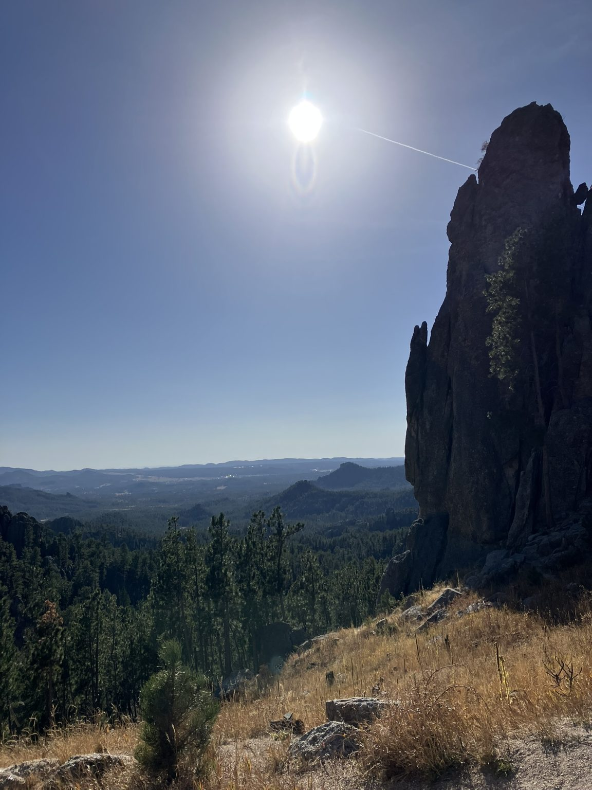


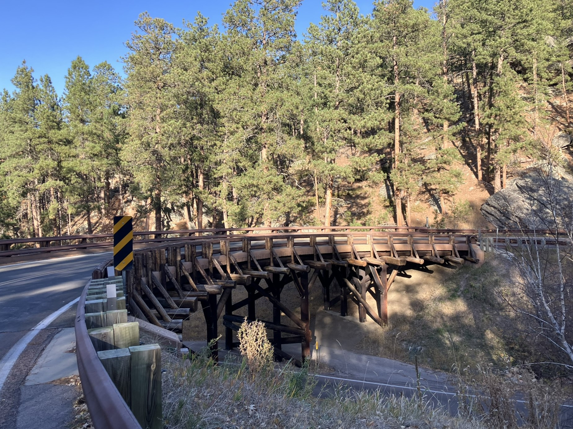
Needles Highway sort of morphed into Iron Mountain Road at some point (also part of the Norbeck byway), which connects Mount Rushmore to Custer State Park. It’s another splendid mountain road, about 18 miles long, described as “a work of art in itself,” winding around the mountainside, with some interesting “pigtail” bridges along the way.

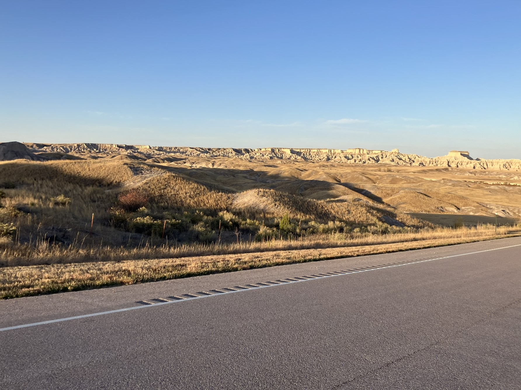
Then the drive back to Wall, but the meandering way, heading to the southern entrance of Badlands National Park, south of Wall, about 85 miles south east on route 40 to Rockyford, and from there into the Badlands, which is named for the Oglala Lakota name, Mako Sica, “land bad”. Allegedly, French trappers called it, “les mauvaises terres pour traverse,” translated into “bad lands to travel through.”
Route 40 passed through some nice local scenery, but got more interesting as I neared Rockyford and turned north onto BAI (Bureau of Indian Affairs) route 41, and then BAI 2, which is a grit and sand covered road. Here, the roads are far more desolate with little traffic, although it was also getting late in the afternoon.
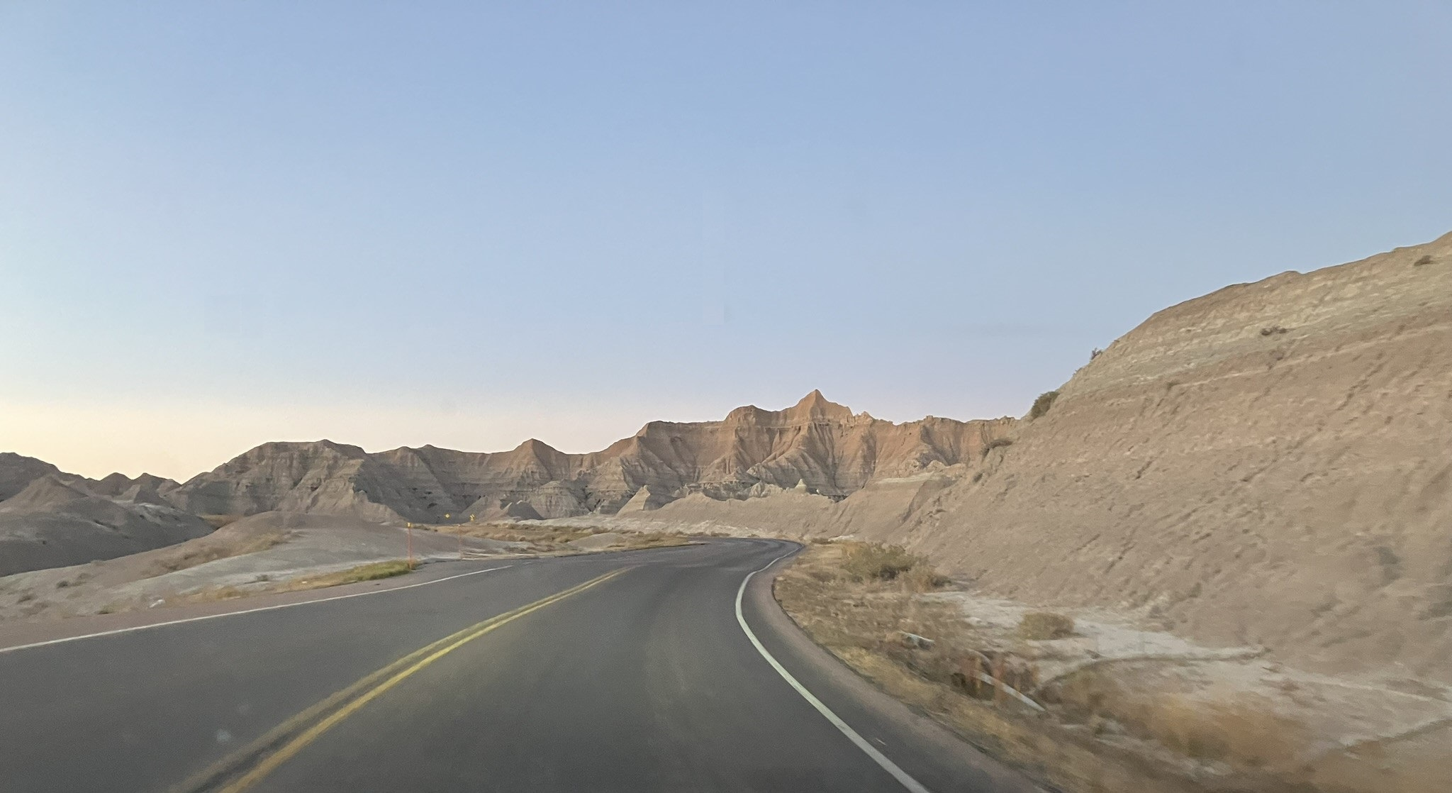
At this point, in a pretty desolate area, I wondered if google maps was again giving me a ridiculous route (as it has before), as my car GPS was showing me a completely different, and a much longer, route – but it has been seriously wrong too. I decided to take the google maps option, but passed on the first option to take a basically dirt road back toward Wall. That seemed like a bad idea, so I instead followed the car GPS at that point, on the Badlands Loop Scenic Road, which I followed for a while before heading back onto the google maps route again. In either case, just like Custer State Park, I kept passing in and out of the national park, regularly seeing signs telling me I was entering the park, only to be followed by signs that said I was leaving the park.
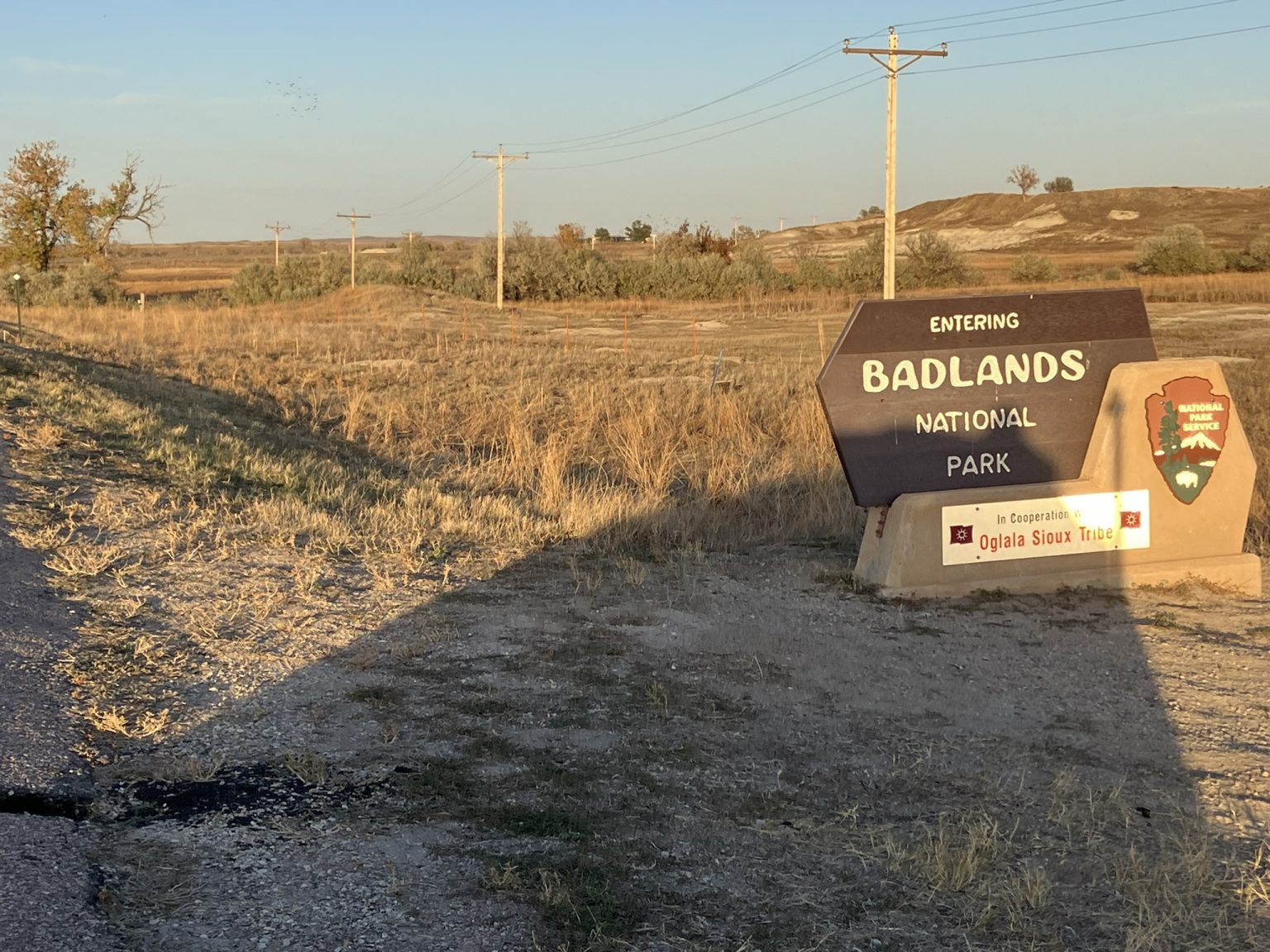
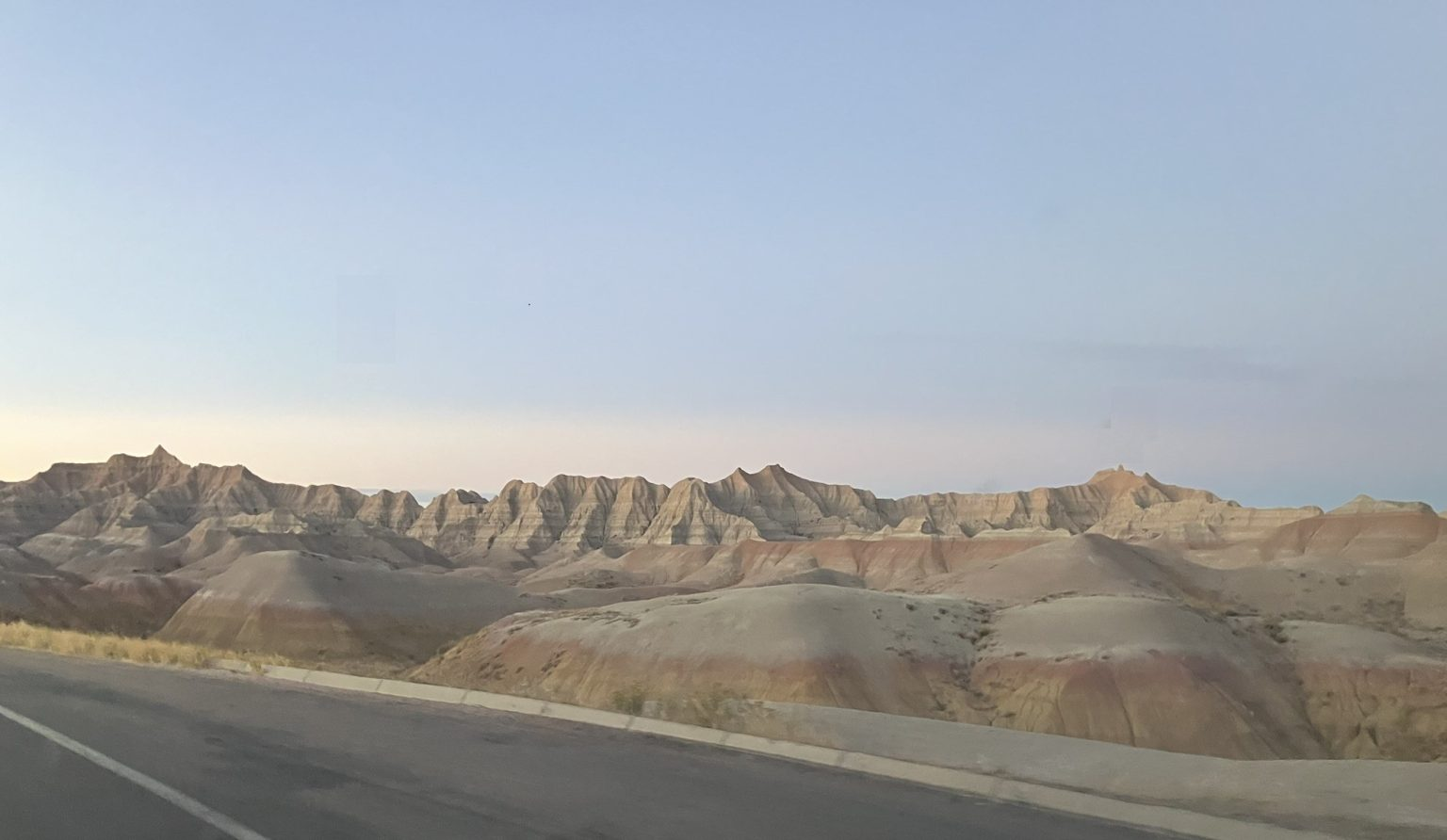
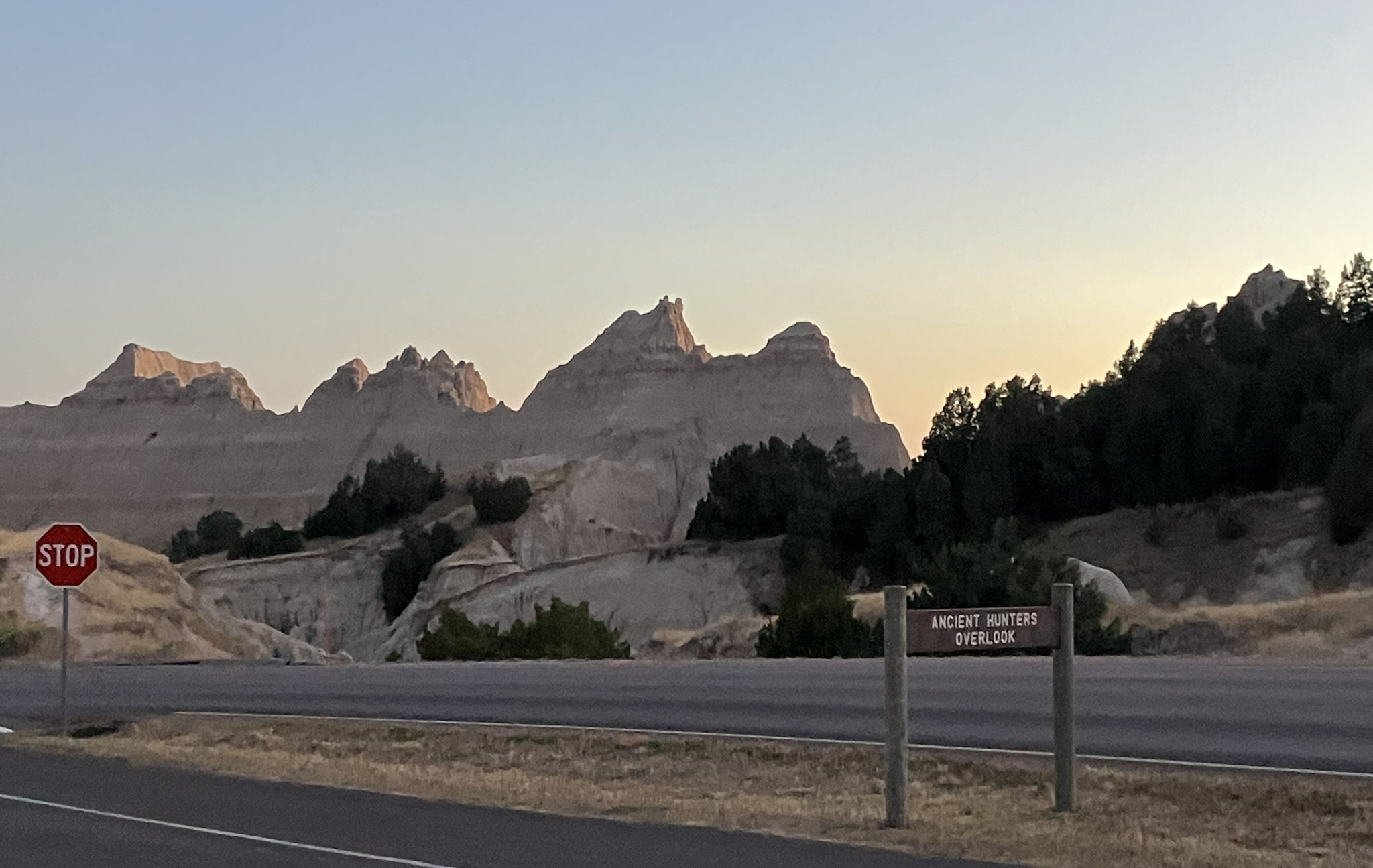
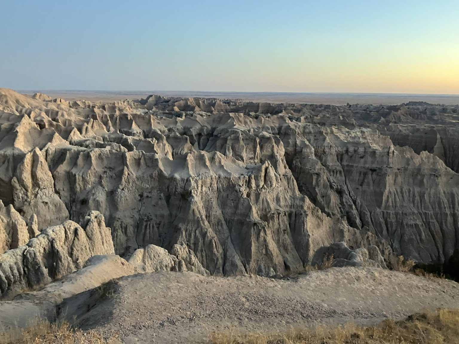
At any rate, this was the Badlands. At first, I could see ravines and gullies off the highway, which resembled a small Grand Canyon, but as I headed north and entered the Badlands and the national park, the landscape changed dramatically, and was incredible (there’s that word again) and almost unearthly. The Badlands are characterized by steep hills and slopes rising out of the ground, buttes, spires, gullies, and ravines, with small salt flats along the way. Wow!

After driving along an empty and grit covered BAI road for some time, the car GPS finally agreed with google maps, and I felt more assured, especially as it was starting to get dark, and eventually I reached an actual entrance gate for the park, but from there it wasn’t too far back to Wall.
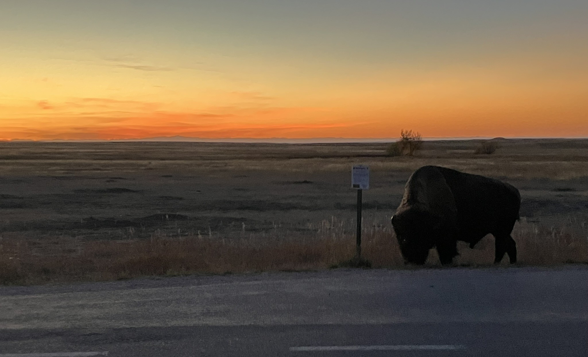
As it started to darken a little, I saw dozens of prairie dogs, two or three at a time, scurrying fast across the road, diagonally from right to left, as though they were all headed to a party somewhere on the left side side of the road. finally, as I neared Wall, I saw a bison grazing by the side of the road, at sunset. Couldn’t be more perfect.
Tomorrow, I head to Sioux Falls, South Dakota, at which point I’ll be about a third of the way back across country. From there, I’ll have to figure out where to next as I head home.